Results


Page 1 of 1
- Weidner, Johanna, Waterloo Chronicle (Waterloo, On1868), 15 Nov 2018, p. 6 Instead of relocating a pedestrian crossing on Bridgeport Road, a second one will be added nearby.Weidner, Johanna, Waterloo Chronicle (Waterloo, On1868), 15 Nov 2018, p. 6 Instead of relocating a pedestrian crossing on Bridgeport Road, a second one …
- Vrbanac, Bob, Waterloo Chronicle, 1 Feb 2018, p. 15 Photo of Chris and Mike Tudisco in front of the Vines sign.Vrbanac, Bob, Waterloo Chronicle, 1 Feb 2018, p. 15 Photo of Chris and Mike Tudisco in front of the Vines sign.
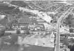
- Stable for race horses built in 1888 at this location by Joseph E. Seagram. Sold in 1937 to J.M. Schneider Limited and used as a stock farm. Sold for residential development in 1957 and demolished.Stable for race horses built in 1888 at this location by Joseph …
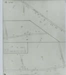
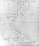
- Fire Insurance map from 1942 of a northwest section of of Waterloo, Erb Street between McDougall Avenue and Amos Avenue. A separate section showing Bridgeport Road and Margaret Avenue is included.Fire Insurance map from 1942 of a northwest section of of Waterloo, …
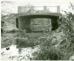
- View of Weber Street bridge over Laurel Creek, just north of Bridgeport. Note the gravel truck on the bridge unloading.View of Weber Street bridge over Laurel Creek, just north of Bridgeport. …
- Please scroll to the bottom of the page to see the transcribed text. To see the original document, please visit the Ellis Little Local History Room at the Main Branch of the Waterloo Public LibraryPlease scroll to the bottom of the page to see the transcribed …
- Jackson, Adam, Waterloo Chronicle, 15 Mar 2018, p. 6 Rendered photo of proposed development.Jackson, Adam, Waterloo Chronicle, 15 Mar 2018, p. 6 Rendered photo of proposed development.
- Please scroll to the bottom of the page to see the transcribed text. To see the original document, please visit the Ellis Little Local History Room at the Main Branch of the Waterloo Public LibraryPlease scroll to the bottom of the page to see the transcribed …
- To see the original document please visit the Ellis Little Local History Room at the Main Branch of the Waterloo Public LibraryTo see the original document please visit the Ellis Little Local History …
- Beattie, Samantha, Waterloo Chronicle, 27 Apr 2017, p. 4, column 1 A new parking structure is to be built in Uptown Waterloo.Beattie, Samantha, Waterloo Chronicle, 27 Apr 2017, p. 4, column 1 A new parking structure is to be built in Uptown Waterloo.
- To see the original document please visit the Ellis Little Local History Room at the Main Branch of the Waterloo Public Library There is some speculation on if Gertrude was actually related to WilliaTo see the original document please visit the Ellis Little Local History …
- Please scroll to the bottom of the page to see the transcribed text. To see the original document, please visit the Ellis Little Local History Room at the Main Branch of the Waterloo Public LibraryPlease scroll to the bottom of the page to see the transcribed …
- To see the original document please visit the Ellis Little Local History Room at the Main Branch of the Waterloo Public LibraryTo see the original document please visit the Ellis Little Local History …
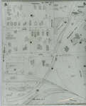
- 1908 map updated to 1913. Duke Street later became Dupont Street. Bridgeport Road also called Laurel Street. See Detail images for closer view of map.1908 map updated to 1913. Duke Street later became Dupont Street. Bridgeport …
- Bellevue Avenue later became Tweed Street. Cedar Street later became Bridgeport Road and was also called Laurel Street east of Peppler Street ca. 1950s.Bellevue Avenue later became Tweed Street. Cedar Street later became Bridgeport Road …
- Lexington Road at Bridgeport Street later became Lincoln Road and was altered slightly at Weber Street. Elmer Street later became Graham Street. David Street later became Roger Street.Lexington Road at Bridgeport Street later became Lincoln Road and was altered …
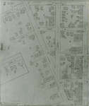
- Fire Insurance map of southwest business district of Waterloo, Young Street to the north, Duke (later Dupont) Street to the south, Albert Street to the west and King Street to the east. Town Hall, LiFire Insurance map of southwest business district of Waterloo, Young Street to …
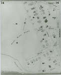
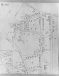
- 1942 Map. Duke Street became Dupont Street. Queen Street became Regina Street. Cedar Street became Bridgeport Road and was also called Laurel Street east of Peppler Street.1942 Map. Duke Street became Dupont Street. Queen Street became Regina Street. …
- 1942 Map. Duke Street became Dupont Street. Queen Street became Regina Street. Cedar Street became Bridgeport Road and was also called Laurel Street east of Peppler Street.1942 Map. Duke Street became Dupont Street. Queen Street became Regina Street. …
Page 1 of 1


