Results


Page 1 of 1
- This is a map of Onondaga Township made in 1939. The original map was provided by Al Robinson during a Scan & Share Day event held at the Onondaga Hall on February 11, 2012.This is a map of Onondaga Township made in 1939. The original …
- This is a copy of a map showing the plots in the Salt Springs Cemetery. The original document was provided by Brian Coleman during a Scan & Share Day event held at the Onondaga Hall on January 14, 20This is a copy of a map showing the plots in the …
- This is a copy of an Onondaga Township map. The map was made circa 1920. The original document was provided by Barbara Plant during a Scan & Share Day event held at the Onondaga Hall on February 11,This is a copy of an Onondaga Township map. The map was …
- "County of Brant" is used to refer to a geographic region rather than the current municipality by the same name. Maps of Brantford are included in this atlas."County of Brant" is used to refer to a geographic region rather …
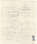
- This is a deed of land to John Kenneth Black and his wife Clara Bell Black who purchased a farm from James Black of the Township of Onondaga in November 1951. It includes a plan showing the survey ofThis is a deed of land to John Kenneth Black and his …
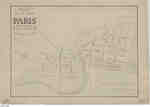
- This is the earliest existing town plan of Paris, which was created in 1847 by F. Herbst based on a survey by Thomas Allchin, the deputy provincial surveyor. The earliest town plan was prepared by LeThis is the earliest existing town plan of Paris, which was created …
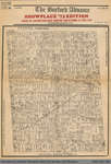
- This item is a reproduction of an 1875 map showing all land grants in Burford Township. This reproduction was printed as the cover for the October 3rd, 1973 edition of the Burford Advance.This item is a reproduction of an 1875 map showing all land …
- This 1876 town map shows Paris as it was at the time. The lots are numbered individually. A number of notable town landmarks are indicated, with the key in the lower centre of the map.This 1876 town map shows Paris as it was at the time. …
- This land indenture documents an agreement between Capron and the Great Western Railway Company. This is not the first agreement between Capron and the Great Western Railway company; an earlier documThis land indenture documents an agreement between Capron and the Great Western …
- This item is a reproduction of an 1894 map depicting the village of Scotland in the Townships of Burford and Oakland, County of Brant. It was produced by Jones & Fairchild, Ontario Land Surveyors. ThThis item is a reproduction of an 1894 map depicting the village …
- Pages 2 through 4 of this map appear to have been cropped from an originally larger map, and cut off abruptly at the edges.Pages 2 through 4 of this map appear to have been cropped …
- This item was digitized on November 14th, 2009, during a Digitization Days event at the Paris Branch of the County of Brant Public Library.This item was digitized on November 14th, 2009, during a Digitization Days …
- This abstract of title provides the transactional history of the portions of Lot 30 in Dumfries, which had at various times belonged to Thomas Clark, William Dickson, John Holme, Samuel Street and HiThis abstract of title provides the transactional history of the portions of …
Page 1 of 1




![Brant County Illustrated [Atlas] Brant County Illustrated [Atlas]](https://images.ourontario.ca/Partners/cbpl/CBPL069862t.jpg)

