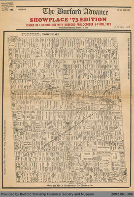
Reproduction of 1875 Map of Burford Township
Description
- Media Type
- Newspaper
- Image
- Description
- This item is a reproduction of an 1875 map showing all land grants in Burford Township. This reproduction was printed as the cover for the October 3rd, 1973 edition of the Burford Advance.
- Date of Publication
- 1973
- Date Of Event
- 1875
- Subject(s)
- Local identifier
- 2002.061.306
- Collection
- Mel Robertson Collection
- Language of Item
- English
- Geographic Coverage
-
-
Ontario, Canada
Latitude: 43.0834 Longitude: -80.49968
-
- Copyright Statement
- Copyright status unknown. Responsibility for determining the copyright status and any use rests exclusively with the user.
- Recommended Citation
- Reproduction of 1875 Map of Burford Township, 1973. Burford Township Historical Society, Item No. 2002.061.306.
- Terms of Use
- The information and images provided are for personal research only and are not to be used for commercial purposes. Use of this information should include the credit "Burford Township Historical Society and Museum."
- Contact
- Burford Township Historical SocietyEmail:info@burfordtownshipmuseum.ca
Website:
Agency street/mail address:141 Harley Road, Harley, ON N0E 1E0


