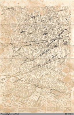
Onondaga Township Map
Description
- Media Type
- Image
- Text
- Item Type
- Maps
- Description
- This is a copy of an Onondaga Township map. The map was made circa 1920.
The original document was provided by Barbara Plant during a Scan & Share Day event held at the Onondaga Hall on February 11, 2012. - Date of Original
- [ca. 1920]
- Dimensions
-
Width: 29 cm
Height: 44.5 cm
- Subject(s)
- Local identifier
- 2012OC113
- Language of Item
- English
- Geographic Coverage
-
-
Ontario, Canada
Latitude: 43.1168 Longitude: -80.11635
-
- Donor
- Provided by Barbara Plant.
- Copyright Statement
- Public domain: Copyright has expired according to Canadian law. No restrictions on use.
- Recommended Citation
- Onondaga Township Map, ca. 1920. Barbara Plant Personal Collection.
- Terms of Use
- The information and images provided are for personal research only and are not to be used for commercial purposes. Use of this information should include the credit "The County of Brant Public Library".
- Contact
- County of Brant Public LibraryEmail:digitalhistory@brant.ca
Website:
Agency street/mail address:County of Brant Public Library (Paris Branch)
12 William Street
Paris, ON
N3L 1K7 | @brantlibrary


