Results


Page 1 of 1
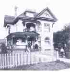
- Photo in book.7 Young Street WestThis is an index record. To read the full article, please visit the Ellis Little Local History Room.Photo in book.7 Young Street WestThis is an index record. To read …
- Photo published in "100 Years of Progress in Waterloo County, Canada: semi-centennial souvenir 1856-1906".Photo published in "100 Years of Progress in Waterloo County, Canada: semi-centennial …
- Photo in book.This is an index record. To read the full article, please visit the Ellis Little Local History Room.Photo in book.This is an index record. To read the full article, …
- The digital file associated with this record is a scan of a photocopy.The digital file associated with this record is a scan of a …
- Struthers, Joy, Waterloo Chronicle, 26 Oct 2017, p. 7 Photo of the Read family in front of the tree.Struthers, Joy, Waterloo Chronicle, 26 Oct 2017, p. 7 Photo of the Read family in front of the tree.
- Please scroll to the bottom of the page to see the transcribed text. To see the original document, please visit the Ellis Little Local History Room at the Main Branch of the Waterloo Public LibraryPlease scroll to the bottom of the page to see the transcribed …
- Jackson, Adam, Waterloo Chronicle (Waterloo, On1868), 20 Sep 2018, p. 5 Proposed design rendering pictured.Jackson, Adam, Waterloo Chronicle (Waterloo, On1868), 20 Sep 2018, p. 5 Proposed design rendering pictured.
- Please scroll to the bottom of the page to see the transcribed text. To see the original document, please visit the Ellis Little Local History Room at the Main Branch of the Waterloo Public LibraryPlease scroll to the bottom of the page to see the transcribed …
- Vrbanac, Bob, Waterloo Chronicle, 21 Dec 2017, p. 1 Photo of the tree on Fountain Street and the Charlie Voelker house.Vrbanac, Bob, Waterloo Chronicle, 21 Dec 2017, p. 1 Photo of the tree on Fountain Street and the Charlie Voelker house.
- Please scroll to the bottom of the page to see the transcribed text. To see the original document, please visit the Ellis Little Local History Room at the Main Branch of the Waterloo Public LibraryPlease scroll to the bottom of the page to see the transcribed …
- Vrbanac, Bob, Waterloo Chronicle, 5 Oct 2017, p. 3 Photo of parents walking kids on Peppler Street.Vrbanac, Bob, Waterloo Chronicle, 5 Oct 2017, p. 3 Photo of parents walking kids on Peppler Street.
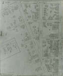
- Dearborn Street became University Avenue at Albert Street, also Schneider's Road became University Avenue at King Street. Ervin Street later became Lester Street. Unger Street later became Sunview StDearborn Street became University Avenue at Albert Street, also Schneider's Road became …
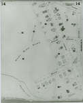
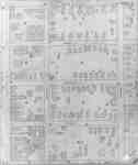
- Fire Insurance map of southwest business district of Waterloo, Young Street to the north, Duke (later Dupont) Street to the south, Albert Street to the west and King Street to the east. Town Hall, LiFire Insurance map of southwest business district of Waterloo, Young Street to …
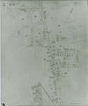
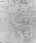
- 1942 Map. Duke Street became Dupont Street. Queen Street became Regina Street. Cedar Street became Bridgeport Road and was also called Laurel Street east of Peppler Street.1942 Map. Duke Street became Dupont Street. Queen Street became Regina Street. …
- 1942 Map. Duke Street became Dupont Street. Queen Street became Regina Street. Cedar Street became Bridgeport Road and was also called Laurel Street east of Peppler Street.1942 Map. Duke Street became Dupont Street. Queen Street became Regina Street. …
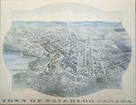
- The printed date in the right hand corner of the second version of the map is incorrect. The map can be dated to ca. 1891 based on other copies and the presence of St. Louis Roman Catholic Church onThe printed date in the right hand corner of the second version …
- 1946, 1951 and 1956 show a service station and White Rose Inn and restaurant at 188 King north. Unclear if the service station and inn were jointly owned or two separate businesses. Main Street becam1946, 1951 and 1956 show a service station and White Rose Inn …
Page 1 of 1
Meet Your Waterloo is created and maintained by the Waterloo Public Library.
Waterloo Public Library is very grateful to the Good Foundation Inc. and the Waterloo Regional Heritage Foundation for their generous funding of the Waterloo Chronicle digitization project.

Thanks to the Archives of Ontario for supporting this project.

Waterloo Public Library is very grateful to the Good Foundation Inc. and the Waterloo Regional Heritage Foundation for their generous funding of the Waterloo Chronicle digitization project.
Thanks to the Archives of Ontario for supporting this project.


