Results
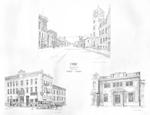
- Canadian Bank of Commerce opened in Waterloo at King and Erb streets in 1889.Canadian Bank of Commerce opened in Waterloo at King and Erb streets …
- Dominion Life established in 1889 as Dominion Life Assurance Company. Bought by Manulife in 1985.Dominion Life established in 1889 as Dominion Life Assurance Company. Bought by …
- Company began as Snyder, Roos Upholstering Company in 1885 on King Street just south of Erb Street. In 1903 the founders, Herbert M. Snyder and his brother Alfred H., and their two sisters and HenryCompany began as Snyder, Roos Upholstering Company in 1885 on King Street …
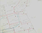
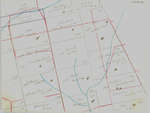
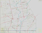
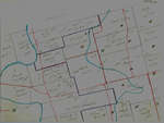
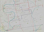
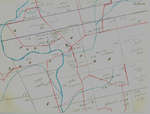
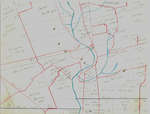
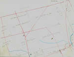
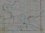
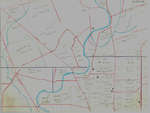
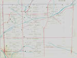
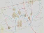
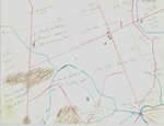
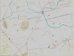
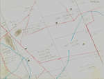
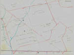
- These maps are hand drawn by Ellis Little and outline over 90000 acres of land granted (Block 2, Waterloo Township) to the Six Nations Indians by the British Crown in 1784 and sold in 1798 to RichardThese maps are hand drawn by Ellis Little and outline over 90000 …
- These maps are hand drawn by Ellis Little and outline over 90000 acres of land granted (Block 2, Waterloo Township) to the Six Nations Indians by the British Crown in 1784 and sold in 1798 to RichardThese maps are hand drawn by Ellis Little and outline over 90000 …
- These maps are hand drawn by Ellis Little and outline over 90000 acres of land granted (Block 2, Waterloo Township) to the Six Nations Indians by the British Crown in 1784 and sold in 1798 to RichardThese maps are hand drawn by Ellis Little and outline over 90000 …
- These maps are hand drawn by Ellis Little and outline over 90000 acres of land granted (Block 2, Waterloo Township) to the Six Nations Indians by the British Crown in 1784 and sold in 1798 to RichardThese maps are hand drawn by Ellis Little and outline over 90000 …
- These maps are hand drawn by Ellis Little and outline over 90000 acres of land granted (Block 2, Waterloo Township) to the Six Nations Indians by the British Crown in 1784 and sold in 1798 to RichardThese maps are hand drawn by Ellis Little and outline over 90000 …
- These maps are hand drawn by Ellis Little and outline over 90000 acres of land granted (Block 2, Waterloo Township) to the Six Nations Indians by the British Crown in 1784 and sold in 1798 to RichardThese maps are hand drawn by Ellis Little and outline over 90000 …
- These maps are hand drawn by Ellis Little and outline over 90000 acres of land granted (Block 2, Waterloo Township) to the Six Nations Indians by the British Crown in 1784 and sold in 1798 to RichardThese maps are hand drawn by Ellis Little and outline over 90000 …
- These maps are hand drawn by Ellis Little and outline over 90000 acres of land granted (Block 2, Waterloo Township) to the Six Nations Indians by the British Crown in 1784 and sold in 1798 to RichardThese maps are hand drawn by Ellis Little and outline over 90000 …
- These maps are hand drawn by Ellis Little and outline over 90000 acres of land granted (Block 2, Waterloo Township) to the Six Nations Indians by the British Crown in 1784 and sold in 1798 to RichardThese maps are hand drawn by Ellis Little and outline over 90000 …
- These maps are hand drawn by Ellis Little and outline over 90000 acres of land granted (Block 2, Waterloo Township) to the Six Nations Indians by the British Crown in 1784 and sold in 1798 to RichardThese maps are hand drawn by Ellis Little and outline over 90000 …
- These maps are hand drawn by Ellis Little and outline over 90000 acres of land granted (Block 2, Waterloo Township) to the Six Nations Indians by the British Crown in 1784 and sold in 1798 to RichardThese maps are hand drawn by Ellis Little and outline over 90000 …
- These maps are hand drawn by Ellis Little and outline over 90000 acres of land granted (Block 2, Waterloo Township) to the Six Nations Indians by the British Crown in 1784 and sold in 1798 to RichardThese maps are hand drawn by Ellis Little and outline over 90000 …
- These maps are hand drawn by Ellis Little and outline over 90000 acres of land granted (Block 2, Waterloo Township) to the Six Nations Indians by the British Crown in 1784 and sold in 1798 to RichardThese maps are hand drawn by Ellis Little and outline over 90000 …
- These maps are hand drawn by Ellis Little and outline over 90000 acres of land granted (Block 2, Waterloo Township) to the Six Nations Indians by the British Crown in 1784 and sold in 1798 to RichardThese maps are hand drawn by Ellis Little and outline over 90000 …
- These maps are hand drawn by Ellis Little and outline over 90000 acres of land granted (Block 2, Waterloo Township) to the Six Nations Indians by the British Crown in 1784 and sold in 1798 to RichardThese maps are hand drawn by Ellis Little and outline over 90000 …
- These maps are hand drawn by Ellis Little and outline over 90000 acres of land granted (Block 2, Waterloo Township) to the Six Nations Indians by the British Crown in 1784 and sold in 1798 to RichardThese maps are hand drawn by Ellis Little and outline over 90000 …
- These maps are hand drawn by Ellis Little and outline over 90000 acres of land granted (Block 2, Waterloo Township) to the Six Nations Indians by the British Crown in 1784 and sold in 1798 to RichardThese maps are hand drawn by Ellis Little and outline over 90000 …


