Aerial Photographs
Records
Results


Page 1 of 1
- The beef farm was originally owned by the Mortimer family in the 1800s. This photo can be found in the Tweedsmuir History created by the Princess Elizabeth Women's Institute.The beef farm was originally owned by the Mortimer family in the …
- This photo can be found in the Tweedsmuir History created by the Nesterville Women's Institute. The beginnings of Nestorville are as follows: In 1905 Frank Nestor was scanning MacBeth Bay looking forThis photo can be found in the Tweedsmuir History created by the …
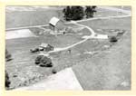
- This is a black and white aerial photo of the Seabrook Farm, S.W.1/4 of Lot 15. Four buildings can be seen in the centre of the photo including a two-story house, a barn, and two other out buildings.This is a black and white aerial photo of the Seabrook Farm, …
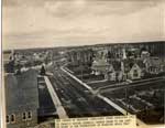
- Land for the first Anglican Church was purchased on October 16, 1890 on the north side of Algoma St. E. and a small church was built shortly thereafter. A new property was purchased in January 1912 oLand for the first Anglican Church was purchased on October 16, 1890 …
- This is a sepia aerial photograph of the main street of Thessalon. The main street is on the left hand portion of the photograph. In the right hand side a number of businesses and private homes can bThis is a sepia aerial photograph of the main street of Thessalon. …
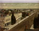
- This is a colourized photo of Main Street, Thessalon looking south to Lake Huron. The cement sidewalks were built in 1909 and well maintained. The buildings appear to be a mix of commercial and residThis is a colourized photo of Main Street, Thessalon looking south to …
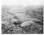
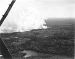
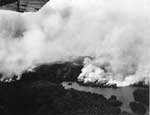
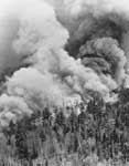
- This is the first of fourteen photo reproductions folder called "Fires" kept in the Thessalon Union Public Library. It is thought that these photos may be related to the report "The Mississagi Fire 1This is the first of fourteen photo reproductions folder called "Fires" kept …
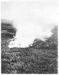
- This is the second of fourteen photo reproductions in a folder called "Fires" kept in the Thessalon Union Public Library, thought to be related to "The Mississagi Fire 1948 Historical Account". ThisThis is the second of fourteen photo reproductions in a folder called …
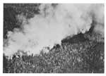
- This is the third of fourteen photo reproductions in a folder called "Fires", thought to be related to "The Mississagi Fire 1948 Historical Account" contained in the same folder. This aerial photo shThis is the third of fourteen photo reproductions in a folder called …
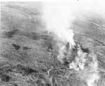
- This is the fourth of fourteen photo reproductions in a folder called "Fires", thought to be related to "The Mississagi Fire 1948 Historical Account" contained in the same folder. This aerial photo,This is the fourth of fourteen photo reproductions in a folder called …
- This is the fifth of fourteen black and white photo reproductions pictures in a folder called "Fires", thought to be related to "The Mississagi Fire 1948 Historical Account" contained in the same folThis is the fifth of fourteen black and white photo reproductions pictures …
- This is the sixth of fourteen photo reproductions in a folder called "Fires", thought to be related to "The Mississagi Fire 1948 Historical Account" contained in the same folder. This aerial photo shThis is the sixth of fourteen photo reproductions in a folder called …
- This is the twelth of fourteen black and white photo reproductions in a folder called "Fires", thought to be related to "The Mississagi Fire 1948 Historical Account" contained in the same folder. ThiThis is the twelth of fourteen black and white photo reproductions in …
- A typewritten note reads " Taken in 1988"A typewritten note reads " Taken in 1988"
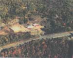
- The farm was originally acquired from Robert Stewart in the early 1900's. Gordon Hern took over the farm in 1958, married Marjorie Mills (Yates) in 1966. They lived on the farm until 1995. This photoThe farm was originally acquired from Robert Stewart in the early 1900's. …
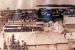
- This is a black and white panorama style photo of the town of Thessalon taken from a high vantage point on the west side of town. The photograph shows a large part of the town including 5 ships on LaThis is a black and white panorama style photo of the town …
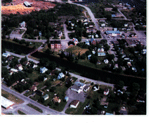
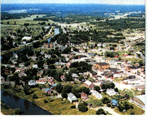
- This is a coloured aerial photo of part of Thessalon. The Thessalon River run across the middle of the photo with the red bridge crossing it on the left. On either side of the river houses can be seeThis is a coloured aerial photo of part of Thessalon. The Thessalon …
- This is a coloured aerial photo of portions of the Town of Thessalon and rural area, in summer looking north-east towards Highway 17. The Thessalon River runs along the left third of the photo, withThis is a coloured aerial photo of portions of the Town of …
- While the front of the photo indicates this is Genelle Street North, Genelle Street runs East and West.While the front of the photo indicates this is Genelle Street North, …
- This is a colour photo of an aerial view of Thessalon showing a summer view of the eastern half of the Town. Some of the recognizable landmarks are the Thessalon Arena in the lower right, St. AmbroseThis is a colour photo of an aerial view of Thessalon showing …
Page 1 of 1

