Results
- The Spencer Farm was located in the 6th Concession, west of Brooklin.The Spencer Farm was located in the 6th Concession, west of Brooklin.
- Spencer Farm was located in Concession 6, west of Brooklin.Spencer Farm was located in Concession 6, west of Brooklin.
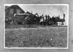
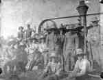
- This picture shows the first traction steam engine east of Toronto at Pat Grady's farm at Audley. The engine was built by the Waterloo Manufacturing Company of Waterloo, Ontario.This picture shows the first traction steam engine east of Toronto at …
- Illustrated Historical Atlas of the County of Ontario, Ont. (Toronto, Ontario: J.H. Beers & Co., 1877), 1877, P.# 20 This farm was located on lot 20 of the north side of the 7th Concession east of Thickson Road in Whitby Township.Illustrated Historical Atlas of the County of Ontario, Ont. (Toronto, Ontario: J.H. Beers & Co., 1877), 1877, P.# 20 This farm was located on lot 20 of the north side of …
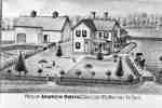
- Unknown, Illustrated Historical Atlas of the County of Ontario, Ont. (Toronto, Ontario: J.H. Beers & Co., 1877), 1877, P.# 20 The residence of Andrew Orvis was located on lot 35 on Concession 1 south of the Grand Trunk Railway (Canadian National Railway) in Whitby Township.Unknown, Illustrated Historical Atlas of the County of Ontario, Ont. (Toronto, Ontario: J.H. Beers & Co., 1877), 1877, P.# 20 The residence of Andrew Orvis was located on lot 35 on Concession …
- Unknown, Illustrated Historical Atlas of the County of Ontario, Ont. (Toronto, Ontario: J.H. Beers & Co., 1877), 1877 Springfield Farm was located on lot 26 on the north side of Concession 7 in Whitby Township.Unknown, Illustrated Historical Atlas of the County of Ontario, Ont. (Toronto, Ontario: J.H. Beers & Co., 1877), 1877 Springfield Farm was located on lot 26 on the north side of …
- Unknown, Illustrated Historical Atlas of the County of Ontario, Ont. (Toronto, Ontario: J.H. Beers & Co., 1877), 1977 John R. Hill lived on the north half of lot 27 of Concession 4 (Taunton Road) in Whitby Township.Unknown, Illustrated Historical Atlas of the County of Ontario, Ont. (Toronto, Ontario: J.H. Beers & Co., 1877), 1977 John R. Hill lived on the north half of lot 27 of …
- Unknown, Illustrated Historical Atlas of the County of Ontario, Ont. (Toronto, Ontario: J.H. Beers & Co., 1877), 1877 L.C. Hall lived on lot 20 on the south side of Concession 1 (Highway 2)and east of Thickson Road.Unknown, Illustrated Historical Atlas of the County of Ontario, Ont. (Toronto, Ontario: J.H. Beers & Co., 1877), 1877 L.C. Hall lived on lot 20 on the south side of Concession …
- Unknown, Illustrated Historical Atlas of the County of Ontario, Ont. (Toronto, Ontario: J.H. Beers & Co., 1877), 1877, P.#4 Madill's farm was also known as Bonny Bank. It was located on the south half of lot 34 of Concession 4 in Whitby Township. The house was demolished in June 2006.Unknown, Illustrated Historical Atlas of the County of Ontario, Ont. (Toronto, Ontario: J.H. Beers & Co., 1877), 1877, P.#4 Madill's farm was also known as Bonny Bank. It was located on …
- Unknown, Illustrated Historical Atlas of the County of Ontario, Ont. (Toronto, Ontario: J.H. Beers & Co., 1877), 1877, P.# 54 William Smith settled on lot 21 of Broken Front Concession in Whitby Township in 1830 or 1831. In his will in 1859 he directed his three sons to erect a house. This cut fieldstone house was built inUnknown, Illustrated Historical Atlas of the County of Ontario, Ont. (Toronto, Ontario: J.H. Beers & Co., 1877), 1877, P.# 54 William Smith settled on lot 21 of Broken Front Concession in Whitby …
- Unknown, Illustrated Historical Atlas of the County of Ontario, Ont. (Toronto, Ontario: J.H. Beers & Co., 1877), 1877, P.# 54 This brick farmhouse was located on lot 21 of Broken Front Concession on the west side of Thickson Road. It was north of the stone house owned by Thomas H. Smith. The John L. Smith house was destroyeUnknown, Illustrated Historical Atlas of the County of Ontario, Ont. (Toronto, Ontario: J.H. Beers & Co., 1877), 1877, P.# 54 This brick farmhouse was located on lot 21 of Broken Front Concession …
- Unknown, Illustrated Historical Atlas of the County of Ontario, Ont. (Toronto, Ontario: J.H. Beers & Co., 1877), 1877 This brick house was built in 1876 on the south east corner of Hopikins and Victoria Streets on lot 22 in Whitby Township. The house was severely damaged by fire in June 2006. Barnabus Gibson was a rUnknown, Illustrated Historical Atlas of the County of Ontario, Ont. (Toronto, Ontario: J.H. Beers & Co., 1877), 1877 This brick house was built in 1876 on the south east corner …
- The Lynde farm, also called Maple Dell Farm, was located on Concession 4 east of Coronation Road in Whitby Township.The Lynde farm, also called Maple Dell Farm, was located on Concession …
- Coldstream Farm was on lot 30 of Concession 1 south of Highway 2 at Lynde Creek in Whitby Township.Coldstream Farm was on lot 30 of Concession 1 south of Highway …
- This brick house was built in 1835 on lot 20 of Concession 7 in Whitby Township. It was located on the north side of the the 7th Concession, east of Thickson Road. A second story was added to the houThis brick house was built in 1835 on lot 20 of Concession …
- This model barn was built in 1903 on Maple Shade Farm (residence of John Dryden) on lot 20 of Concession 7, east of Thickson Road in Whitby Township. It was built for John Dryden (1840-1909) who wasThis model barn was built in 1903 on Maple Shade Farm (residence …
- This house was located on the south side of Dundas Street/Highway 2 between the hydro line that passes east of Bowman Avenue and Glenhill Drive. It was demolished about 1970 or 1971. The house appearThis house was located on the south side of Dundas Street/Highway 2 …
- This barn was located between Ashburn and the Whitby-Pickering Town Line.This barn was located between Ashburn and the Whitby-Pickering Town Line.
- The stone farmhouse was the home of William Heron Sr. (1792-1884) and it remained in the Heron family for many years. It was located on lot 29 of Concession 9 in Whitby Township.The stone farmhouse was the home of William Heron Sr. (1792-1884) and …
- These barns were located on the north side of the Base Line and were demolished in 1939 to build Highway 401. The farm was located on lot 20 of Concession 1, Base Line.These barns were located on the north side of the Base Line …


