Results
- A winter view of Bankfield Mine looking west. Note the water line running to the water tower serving both Bankfield and Tombill Mines. The Bankfield Gold Mines began shaft-sinking in 1934, and threeA winter view of Bankfield Mine looking west. Note the water line …
- View looking southeast from the old Bankfield Highway at Magnet Mine. Today, Highway 11 is beyond the buildings shown here. Inscription reads 'Magnet Consolidated Gold Mine.' Magnet Consolidated GoldView looking southeast from the old Bankfield Highway at Magnet Mine. Today, …
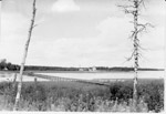
- Black and white photo of mining operation near Geraldton, Ontario.Black and white photo of mining operation near Geraldton, Ontario.
- Group of unidentified prospectors, one of them holding a gold brick.Group of unidentified prospectors, one of them holding a gold brick.
- View of Little Long Lac mining office. From left to right, T.H. Rea, George Rayner, Tony Oklend, Joseph Errington, J.H.C Waite, and two pilots, Boual and George. Rayner Construction had the contractsView of Little Long Lac mining office. From left to right, T.H. …
- Inscription reads 'Pouring of first Gold Brick at MacLeod Cockshutt Gold Mine, May 20th, 1938'.Inscription reads 'Pouring of first Gold Brick at MacLeod Cockshutt Gold Mine, …
- Inscription reads 'First Gold Brick - Bankfield Consolidated Mine June 12, 1937'. The first brick weighed in at 601.19 ounces. The Bankfield Mine was one of the most modern mills in the gold mining iInscription reads 'First Gold Brick - Bankfield Consolidated Mine June 12, 1937'. …
- Hutchinson Lake Gold Mines Ltd., incorporated in 1935, dug a series of trenches and test pits, but not until 1936 did the company begin it's shaft-sinking operation. The photo shows the site after thHutchinson Lake Gold Mines Ltd., incorporated in 1935, dug a series of …
- View looking west at Tombill mine. Note the water line to a short water tower in the foreground of the photo. Tombill Gold Mines was incorporated in 1935 and shaft-sinking began the following year. BView looking west at Tombill mine. Note the water line to a …
- Aerial View looking west towards Wildgoose Lake. The inscription reads 'Air view of Bankfield Consolidated Mine, Tombill Mine, and Jellicoe Mine'. Highway 11 and Bankfield Mine are in the foreground.Aerial View looking west towards Wildgoose Lake. The inscription reads 'Air view …
- Aerial view looking north, along the shoreline of Kenogamisis Lake. Hard Rock Gold Mine was incorporated in 1934 and in 1935 the No.1 shaft was sunk on Discovery Point. Work ceased in 1937 in order tAerial view looking north, along the shoreline of Kenogamisis Lake. Hard Rock …
- Aerial view looking northeast. Inscription reads 'Elmos Mine'. The name of Elmos is a composite for Ellis and Mosher. In the centre is the headframe site on a tiny island, and to the left is a clusteAerial view looking northeast. Inscription reads 'Elmos Mine'. The name of Elmos …
- Aerial view looking west from Kenogamisis Lake. In the foreground is the No.1 headframe of Hardrock Mine. To the extreme right is Hardrock Townsite. In the centre is No.2 headframe of the Hardrock MiAerial view looking west from Kenogamisis Lake. In the foreground is the …
- Aerial view looking northwest. Inscription reads 'MacLeod Cockshutt Gold Mine showing Hard Rock Gold mine in the foreground, December, 1937.' Upper portion shows the hills on which MacLeod Townsite iAerial view looking northwest. Inscription reads 'MacLeod Cockshutt Gold Mine showing Hard …
- Aerial view looking northeast across Barton Bay. Inscription reads 'Little Long Lac Gold mine'. In the foreground is the clearing for Errington Avenue. It would later be called Arena Road and in 1939Aerial view looking northeast across Barton Bay. Inscription reads 'Little Long Lac …
- mines, mining, gold mines, gold, Hardrock mine, headframe, shaft, MacLeod Cockshutt Gold Mine, hydromines, mining, gold mines, gold, Hardrock mine, headframe, shaft, MacLeod Cockshutt Gold …
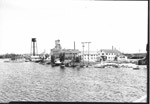
- View of Little Long Lac Mine looking southeast from Barton Bay on Kenogamisis Lake. The hydro transmission tower (double poles) and the absence of the bridge help to date this view. Hydro began serviView of Little Long Lac Mine looking southeast from Barton Bay on …
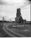
- Greenstone, Geraldton, Mosher mine, mining, mines, gold, OntarioGreenstone, Geraldton, Mosher mine, mining, mines, gold, Ontario
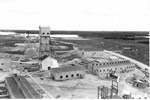
- Elevated view of MacLeod mine looking east towards Hardrock mine. From right to left, the No. 2 headframe of Macleod mine, the No. 2 headframe of Hardrock mine, and barely visible, Hardrock's No.1 heElevated view of MacLeod mine looking east towards Hardrock mine. From right …


