Waterloo Public Library Digital Collections

Results

We found
8
matching items
  • Remove search term Subject: Avondale Avenue Waterloo, Ont.
List Thumb list Columns Gallery
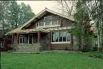
  • Reitzel House at 147 Avondale Ave S.
        Slide was mounted on Pakon brand mount. This information was used to provide an approximate date range for the photo. For more information, see the associated link the City of Waterloo Heritage Prope
      Slide was mounted on Pakon brand mount. This information was used to …
  • Uptown neighbourhood weighs in on traffic
    Desmond, Paige, Waterloo Region Record, 31 Oct 2013, B12     This is an index record. To read the full article, please visit the Ellis Little Local History Room.
    Desmond, Paige, Waterloo Region Record, 31 Oct 2013, B12   This is an index record. To read the full article, please visit …
  • Edgar Fischer Biography
        To see the original document please visit the Ellis Little Local History Room at the Main Branch of the Waterloo Public Library
      To see the original document please visit the Ellis Little Local History …
  • Waterloo residents mobilize against changes
    Desmond, Paige, Waterloo Region Record, 30 Oct 2012, B1     This is an index record. To read the full article, please visit the Ellis Little Local History Room.
    Desmond, Paige, Waterloo Region Record, 30 Oct 2012, B1   This is an index record. To read the full article, please visit …
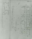
  • Fire Insurance Map 1942, Map 9
        Rudy Avenue became Roslin (sometimes Roslyn in directories) Avenue. Victoria Street later became Avondale Avenue. Charles Street became Dunbar Street. Elizabeth Street became Beverley Street. Weaver
      Rudy Avenue became Roslin (sometimes Roslyn in directories) Avenue. Victoria Street later …
  • Fire Insurance Map 1942, Map 6
        Earl Street became Severn Avenue. Fischer Street became Belmont Avenue. Victoria Street became Avondale Avenue.
      Earl Street became Severn Avenue. Fischer Street became Belmont Avenue. Victoria Street …
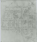
  • Fire Insurance Map 1942, Map 8
        Rudy Avenue became Roslin (sometimes Roslyn in directories) Avenue. Victoria Street later became Avondale Avenue. Charles Street became Dunbar Street. Weaver Street (sometimes Weber Street in directo
      Rudy Avenue became Roslin (sometimes Roslyn in directories) Avenue. Victoria Street later …
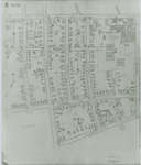
  • Fire Insurance Map 1942, Map 15
        Victoria Street became Avondale Avenue. Shantz Street became Canbar Avenue and no longer exists. Knox Avenue no longer exists. Elizabeth Street became Beverley Street. Rudy Street became Roslin Avenu
      Victoria Street became Avondale Avenue. Shantz Street became Canbar Avenue and no …
Sort
Contributors
Media Types
Groups
Subjects
Item Types
Years
1940s1940194119421943194419451946194719481949
19501950195119521953195419551956195719581959
19601960196119621963196419651966196719681969
19701970197119721973197419751976197719781979
19801980198119821983198419851986198719881989
19901990199119921993199419951996199719981999
20002000200120022003200420052006200720082009
2010s2010201120122013201420152016201720182019
Web Tools
See Alternate Formats
Atom | RSS | Dublin Core | Mods | Solr
Powered by / Alimenté par VITA Toolkit
Privacy Policy