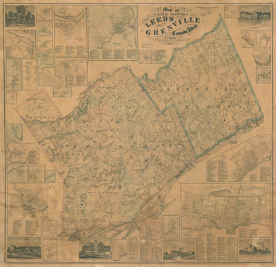
Map of the United Counties of Leeds and Grenville
Description
- Creator
- H.F. Walling, Illustrator
- Media Type
- Image
- Item Type
- Maps
- Description
- This item is a map of the United Counties of Leeds and Grenville, Canada West, as of 1861. It was based on surveys under the direction of H.F. Walling, and includes the townships of Leeds, Lansdowne, and Escott. This map includes some pictures, individual lot and concession numbers for each township, and the names of landowners (by township) in the year the map was produced.
There are insets for towns in the region, including Gananoque, Lyndhurst, Charleston and Escott. - Publisher
- H.F. Walling
- Place of Publication
- New York, NY, USA
- Date of Original
- 1861
- Date Of Event
- 1861
- Map Scale
- 1 mile : 1 inch
- Local identifier
- 988-07
- Language of Item
- English
- Copyright Statement
- Copyright status unknown. Responsibility for determining the copyright status and any use rests exclusively with the user.
- Contact
- Leeds & Thousand Islands Public LibraryEmail:archivist@ltiarchives.ca
Website:
Agency street/mail address:1B Jessie St, P.O. Box 219
Lansdowne, ON K0E 1L0


