Results
- The technology embedded in today's digital camera photographs such as GPS location, compass orientation so we know which way the photographer was facing, date, even time of day will do more to help hThe technology embedded in today's digital camera photographs such as GPS location, …
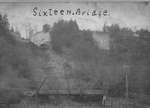
- Artist's drawing of the Eastern bank of the Sixteen Mile Creek in OakvilleArtist's drawing of the Eastern bank of the Sixteen Mile Creek in …
- From the Taras Shevchenko Museum website: "First Ukrainian Immigration to Canada Over one hundred years ago, on September 7, 1891, Ivan Pylypiw and Vasyl Eleniak, two 33-year peasants from the villagFrom the Taras Shevchenko Museum website: "First Ukrainian Immigration to Canada Over …
- Ruth Mary Ann Joyce was the daughter of George and Esther (Brown) Joyce who emigrated from Ireland in 1856-7, settling on a farm south-east of Milton, near Omagh, Ontario. Mary's parents died when shRuth Mary Ann Joyce was the daughter of George and Esther (Brown) …
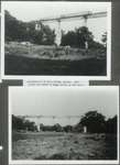
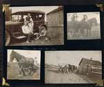
- Note the horse and buggy going up the hill in the top picture, and it's hard to see, but possibly two people with a car to the right. These steep valley hillside roads were sometimes referred to by lNote the horse and buggy going up the hill in the top …
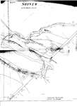
- A cleaned up version of the map is also included in this record, courtesy of Mr. David Hobden. Click on "select" under the title above here. You can move the image around with your mouse to focus onA cleaned up version of the map is also included in this …
- The above information is taken from http://www.oakvillehistory.org/pdf/1841%20census.pdfThe above information is taken from http://www.oakvillehistory.org/pdf/1841%20census.pdf
- Note the two women standing on the bridge. Their long dresses and the power lines indicate this photograph may have been taken around 1920.Note the two women standing on the bridge. Their long dresses and …
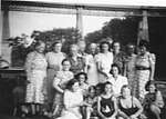
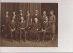
- George and Polly King had 11 children. They enjoyed many family gatherings over the years on the family farms along Dundas at the Sixteen, and on the Sixteen flats. When they all got together with thGeorge and Polly King had 11 children. They enjoyed many family gatherings …
- Laura's parents were George and Mary Ann, called Polly, King who owned the property on Highway 5 (Dundas Street) in Trafalgar Township called The Pines. Laura married George Lockhart Spence on AprilLaura's parents were George and Mary Ann, called Polly, King who owned …
- Laura's parents were George and Mary Ann, called Polly, King who owned the farm on Highway 5 (Dundas Street), Trafalgar Township, called The Pines. Laura was born the year after her father had joinedLaura's parents were George and Mary Ann, called Polly, King who owned …
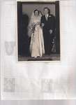
- The ceremony was performed by Rev. C.D. Farris. Although Carol was born in Toronto, her parents moved their family to Trafalgar Township when the children were still young to join their King family rThe ceremony was performed by Rev. C.D. Farris. Although Carol was born …
- The children of this happy family spanned 24 years.The children of this happy family spanned 24 years.
- Ron was also often called by his first name,Frank. Mary married Thomas Kenyon Harold Choate on June 30, 1948. Mary and Ken lived happily in Ken's home town of Peterborough, Ontario. Muriel married KeRon was also often called by his first name,Frank. Mary married Thomas …
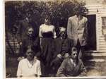
- Joseph died in March 1916 and his son, George, is not in uniform here so we know it was taken before the fall of 1915. Hazel would have been about 10 years old in 1913 and I think she looks a littleJoseph died in March 1916 and his son, George, is not in …
- Mary, my mother, remembered walking up and down the Sixteen "hogsbacks" to reach her grandparents who lived on the Jemmima Biggar farm, on the north east side of the Sixteen and the "Dundas highway".Mary, my mother, remembered walking up and down the Sixteen "hogsbacks" to …
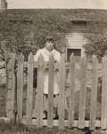
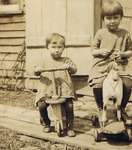
- The girls are dressed in practical playclothes and shoes.The girls are dressed in practical playclothes and shoes.
- This photograph was probably taken at a family home in England just before they emigrated to Canada as family labels say F.R. Powell is 16 years old in the photograph and the family emigrated in 1908This photograph was probably taken at a family home in England just …
- Jemmima Bigger, born September 9, 1826 died May 9, 1909, buried in Munn's Cemetery, Trafalgar, Ontario. Richard and Elizabeth's son Joseph Edward and his wife, Mary Anne, were my mother's grandparentJemmima Bigger, born September 9, 1826 died May 9, 1909, buried in …
This service is sponsored by Jeff Knoll, Local & Regional Councillor for Oakville Ward 5 – Town of Oakville/Regional Municipality of Halton


