Results


Page 1 of 1
- This photo can be found in the Tweedsmuir History created by the Nesterville Women's Institute. The beginnings of Nestorville are as follows: In 1905 Frank Nestor was scanning MacBeth Bay looking forThis photo can be found in the Tweedsmuir History created by the …
- A photo showing Mississauga Crescent and Main Street - Circa 1960. Gardiners garage can be seen as well as an Esso and Shell station and at the far end possibly the Rod and Gun Hotel.A photo showing Mississauga Crescent and Main Street - Circa 1960. Gardiners …
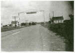
- This black and white photo shows a large wooden structure and sign over the two lane Highway 17 at the west end of the village of Iron Bridge. The sign let travelers know which town they were comingThis black and white photo shows a large wooden structure and sign …
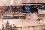
- This is a sepia aerial photograph of the main street of Thessalon. The main street is on the left hand portion of the photograph. In the right hand side a number of businesses and private homes can bThis is a sepia aerial photograph of the main street of Thessalon. …
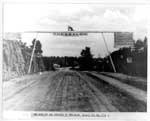
- This is a black and white photo showing Highway 17B coming into Thessalon. There are steep rock walls on either side and the road appears to be dirt. A wooden sign hangs over the roadway announcing tThis is a black and white photo showing Highway 17B coming into …
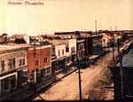
- This is a colourized photo showing the east side of downtown Main Street of Thessalon. The street is lined with multiple buildings and businesses. The majority of the buildings are two story and theThis is a colourized photo showing the east side of downtown Main …
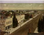
- This is a colourized photo of Main Street, Thessalon looking south to Lake Huron. The cement sidewalks were built in 1909 and well maintained. The buildings appear to be a mix of commercial and residThis is a colourized photo of Main Street, Thessalon looking south to …
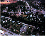
- This is a coloured aerial photo of part of Thessalon. The Thessalon River run across the middle of the photo with the red bridge crossing it on the left. On either side of the river houses can be seeThis is a coloured aerial photo of part of Thessalon. The Thessalon …
- While the front of the photo indicates this is Genelle Street North, Genelle Street runs East and West.While the front of the photo indicates this is Genelle Street North, …
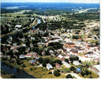
- This is a colour photo of an aerial view of Thessalon showing a summer view of the eastern half of the Town. Some of the recognizable landmarks are the Thessalon Arena in the lower right, St. AmbroseThis is a colour photo of an aerial view of Thessalon showing …
- This is a black and white photo of the Thessalon River, taken from somewhere along the river. The photo shows a view looking north. The Bennett home is visible in the background on the west side of tThis is a black and white photo of the Thessalon River, taken …
- This is a coloured aerial photo of portions of the Town of Thessalon and rural area, in summer looking north-east towards Highway 17. The Thessalon River runs along the left third of the photo, withThis is a coloured aerial photo of portions of the Town of …
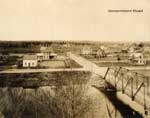
- This is a black and white photo of the "red brige" that crosses the river at Government Road. The photo shows several homes on the west side of the river that are on very large cleared lots that appeThis is a black and white photo of the "red brige" that …
Page 1 of 1


