Results
- Unknown, Illustrated Historical Atlas of the County of Ontario, Ont. (Toronto, Ontario: J.H. Beers & Co., 1877), 1877 The complex of County buildings was located on the west side of Centre Street between Gilbert and Ontario Streets.Unknown, Illustrated Historical Atlas of the County of Ontario, Ont. (Toronto, Ontario: J.H. Beers & Co., 1877), 1877 The complex of County buildings was located on the west side of …
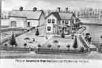
- Illustrated Historical Atlas of the County of Ontario, Ont. (Toronto, Ontario: J.H. Beers & Co., 1877), 1877, P.# 20 This farm was located on lot 20 of the north side of the 7th Concession east of Thickson Road in Whitby Township.Illustrated Historical Atlas of the County of Ontario, Ont. (Toronto, Ontario: J.H. Beers & Co., 1877), 1877, P.# 20 This farm was located on lot 20 of the north side of …
- Unknown, Illustrated Historical Atlas of the County of Ontario, Ont. (Toronto, Ontario: J.H. Beers & Co., 1877), 1877, P.# 20 The residence of Andrew Orvis was located on lot 35 on Concession 1 south of the Grand Trunk Railway (Canadian National Railway) in Whitby Township.Unknown, Illustrated Historical Atlas of the County of Ontario, Ont. (Toronto, Ontario: J.H. Beers & Co., 1877), 1877, P.# 20 The residence of Andrew Orvis was located on lot 35 on Concession …
- Unknown, Illustrated Historical Atlas of the County of Ontario, Ont. (Toronto, Ontario: J.H. Beers & Co., 1877), 1877 Springfield Farm was located on lot 26 on the north side of Concession 7 in Whitby Township.Unknown, Illustrated Historical Atlas of the County of Ontario, Ont. (Toronto, Ontario: J.H. Beers & Co., 1877), 1877 Springfield Farm was located on lot 26 on the north side of …
- Unknown, Illustrated Historical Atlas of the County of Ontario, Ont. (Toronto, Ontario: J.H. Beers & Co., 1877), 1877 L.C. Hall lived on lot 20 on the south side of Concession 1 (Highway 2)and east of Thickson Road.Unknown, Illustrated Historical Atlas of the County of Ontario, Ont. (Toronto, Ontario: J.H. Beers & Co., 1877), 1877 L.C. Hall lived on lot 20 on the south side of Concession …
- Unknown, Illustrated Historical Atlas of the County of Ontario, Ont. (Toronto, Ontario: J.H. Beers & Co., 1877), 1877, P.#4 Madill's farm was also known as Bonny Bank. It was located on the south half of lot 34 of Concession 4 in Whitby Township. The house was demolished in June 2006.Unknown, Illustrated Historical Atlas of the County of Ontario, Ont. (Toronto, Ontario: J.H. Beers & Co., 1877), 1877, P.#4 Madill's farm was also known as Bonny Bank. It was located on …
- Unknown, Illustrated Historical Atlas of the County of Ontario, Ont. (Toronto, Ontario: J.H. Beers & Co., 1877), 1877, P.# 54 William Smith settled on lot 21 of Broken Front Concession in Whitby Township in 1830 or 1831. In his will in 1859 he directed his three sons to erect a house. This cut fieldstone house was built inUnknown, Illustrated Historical Atlas of the County of Ontario, Ont. (Toronto, Ontario: J.H. Beers & Co., 1877), 1877, P.# 54 William Smith settled on lot 21 of Broken Front Concession in Whitby …
- Unknown, Illustrated Historical Atlas of the County of Ontario, Ont. (Toronto, Ontario: J.H. Beers & Co., 1877), 1877, P.# 54 This brick farmhouse was located on lot 21 of Broken Front Concession on the west side of Thickson Road. It was north of the stone house owned by Thomas H. Smith. The John L. Smith house was destroyeUnknown, Illustrated Historical Atlas of the County of Ontario, Ont. (Toronto, Ontario: J.H. Beers & Co., 1877), 1877, P.# 54 This brick farmhouse was located on lot 21 of Broken Front Concession …
- Unknown, Illustrated Historical Atlas of the County of Ontario, Ont. (Toronto, Ontario: J.H. Beers & Co., 1877), 1877 This brick house was built in 1876 on the south east corner of Hopikins and Victoria Streets on lot 22 in Whitby Township. The house was severely damaged by fire in June 2006. Barnabus Gibson was a rUnknown, Illustrated Historical Atlas of the County of Ontario, Ont. (Toronto, Ontario: J.H. Beers & Co., 1877), 1877 This brick house was built in 1876 on the south east corner …
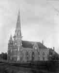
- The Methodist Tabernacle was built in 1875-76 at 201 Centre Street South, south-east corner of Centre and Colborne Streets. It became the Whitby United Church in 1925 and St. Mark's United Church inThe Methodist Tabernacle was built in 1875-76 at 201 Centre Street South, …
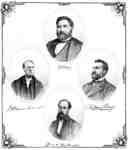
- George Henry Frewen Dartnell was born on February 13, 1834 in the city of Limerick, Ireland. The family came to Toronto in 1850. George Dartnell became a lawyer in Whitby in 1858, Junior Judge of OntGeorge Henry Frewen Dartnell was born on February 13, 1834 in the …
- Richard Hatch was born at Darlington Township on October 7, 1839 and in 1864 started a hardware business at Whitby in partnership with his brother, Samuel Brown Hatch. In 1889 he moved to Toronto wheRichard Hatch was born at Darlington Township on October 7, 1839 and …
- Gorrell, Craig & Co. Lith, Toronto, Illustrated Historical Atlas of the County of Ontario, Ont. (Toronto, Ontario: J.H. Beers & Co., 1877), 1877 This home was located at 401 Dundas Street West, Whitby. It was built in 1877 on the block bounded by Dundas, Henry, Colborne and King Streets. It was demolished in 1958. The owners of the house wereGorrell, Craig & Co. Lith, Toronto, Illustrated Historical Atlas of the County of Ontario, Ont. (Toronto, Ontario: J.H. Beers & Co., 1877), 1877 This home was located at 401 Dundas Street West, Whitby. It was …
- Unknown, Illustrated Historical Atlas of the County of Ontario, Ont. (Toronto, Ontario: J.H. Beers & Co., 1877), 1877 The residence of James Holden was located on the south side of Dundas Street west of Blair Street (at 601 Dundas Street East). It was built in the 1850s and acquired by James Holden after he moved toUnknown, Illustrated Historical Atlas of the County of Ontario, Ont. (Toronto, Ontario: J.H. Beers & Co., 1877), 1877 The residence of James Holden was located on the south side of …
- Unknown, Illustrated Historical Atlas of the County of Ontario, Ont. (Toronto, Ontario: J.H. Beers & Co., 1877), 1877 This house is located at the north-east corner of Mary and Pine Streets (at 201 Pine Street). It was built in the 1850s and demolished in 1976. Owners of this house were the Armstrong Family, W.H. HiUnknown, Illustrated Historical Atlas of the County of Ontario, Ont. (Toronto, Ontario: J.H. Beers & Co., 1877), 1877 This house is located at the north-east corner of Mary and Pine …
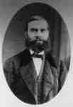
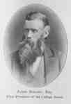
- James Holden (1828-1881) was the first president of the Ontario Ladies' College board of directors from 1874 to 1881. He was also one of the founding members of the College. Mr. Holden was born at StJames Holden (1828-1881) was the first president of the Ontario Ladies' College …
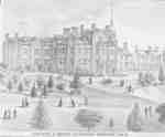
- The principal's residence was converted in 1877 from an old carriage house built for Sheriff Reynolds. Ontario Ladies' College is now known as Trafalgar Castle School, and is located at 401 ReynoldsThe principal's residence was converted in 1877 from an old carriage house …
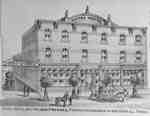
- Royal Hotel was located at 171 Brock Street North which was built in 1873. The first Royal Hotel in Whitby was destroyed by fire in 1872. It is located on the east side of Brock Street, south of MaryRoyal Hotel was located at 171 Brock Street North which was built …
- The J.B. Bickell Mills and residence were located at concession 6, lot 24 in Whitby Township, Ontario. This was on the west side of Lynde Creek south of Way Road. Mr. Bickell left Brooklin about 1883The J.B. Bickell Mills and residence were located at concession 6, lot …
- O'Donovan Carriage Works was located at 300 Brock Street South, in the block bounded by Brock Street, Gilbert Street, Byron Street and Dunlop Street. The entrance faced the west side of Brock Street.O'Donovan Carriage Works was located at 300 Brock Street South, in the …


