Results
- This is a map of Oshawa prior to being made into a town in 1850.This is a map of Oshawa prior to being made into a …
- This group includes information for all maps held in the Local History Room at the McLaughlin Branch of the Oshawa Public Library.This group includes information for all maps held in the Local History …
- Scale on map listed as 1" to 2 milesScale on map listed as 1" to 2 miles
- Scale on map listed as 1" to 1 mileScale on map listed as 1" to 1 mile
- Scale on map listed as 1" to 1 mileScale on map listed as 1" to 1 mile
- Scale on map listed as 2" to 1 mileScale on map listed as 2" to 1 mile
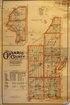
- Illustrated Historical Atlas of the County of Ontario, Ont. (Toronto, Ontario: J.H. Beers & Co., 1877), 1966 This is a 1966 reproduction of the 1867 map that was originally printed in the 1877 Historical Atlas for the County of Ontario.Illustrated Historical Atlas of the County of Ontario, Ont. (Toronto, Ontario: J.H. Beers & Co., 1877), 1966 This is a 1966 reproduction of the 1867 map that was originally …
- Illustrated Historical Atlas of the County of Ontario, Ont. (Toronto, Ontario: J.H. Beers & Co., 1877), 1967 This is a 1967 Centennial reproduction based on the Ontario COunty Historical Atlas from 1877.Illustrated Historical Atlas of the County of Ontario, Ont. (Toronto, Ontario: J.H. Beers & Co., 1877), 1967 This is a 1967 Centennial reproduction based on the Ontario COunty Historical …
- Scale on map listed as 1" to 1 mileScale on map listed as 1" to 1 mile
- Scale on map listed as 1" to 2 milesScale on map listed as 1" to 2 miles
- Scale on map listed as 1" to 3 milesScale on map listed as 1" to 3 miles
- Scale on map listed as 1" to 3.75 milesScale on map listed as 1" to 3.75 miles
- Scale on map listed as 1" to 2.5 milesScale on map listed as 1" to 2.5 miles
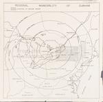
- This map shows an outline of Durham Region and how it looks within 100, 200, 300 and 400 miles radii.This map shows an outline of Durham Region and how it looks …
- Map issued in 1916; note that map is "To accompany Section V of Memoir by L. Reinecke." Scale on map listed as 1" to 4 milesMap issued in 1916; note that map is "To accompany Section V …
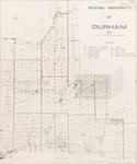
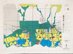
- Proposal for Durham, also noted as discussion paper no. 4. This seems to be 1 of 5 maps that cover the entire Region.Proposal for Durham, also noted as discussion paper no. 4. This seems …
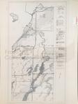
- This hydrogeological map shows a list of major aquifers in southern Durham and York regions, across the Oak Ridges Aquifer Complex.This hydrogeological map shows a list of major aquifers in southern Durham …
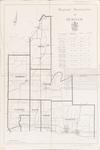
- Make up the Official Plan of Regional Municipality of Durham, 5 maps total.Make up the Official Plan of Regional Municipality of Durham, 5 maps …
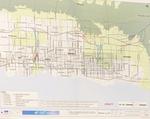
- This map shows the plan and environmental assessment for the 407 East including alternate roadways and plans.This map shows the plan and environmental assessment for the 407 East …
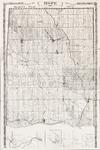
- This is a copy of the 1878 map of Hope Township from Belden's Atlas.This is a copy of the 1878 map of Hope Township from …


