Results
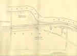
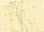
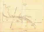
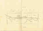
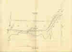
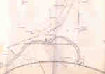
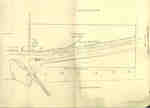
- Survey map of the Second Welland Canal created by the Welland Canal Company showing the canal in the Thorold Township between Port Robinson and Welland. Identified structures and features associatedSurvey map of the Second Welland Canal created by the Welland Canal …
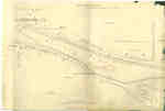
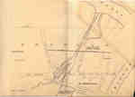
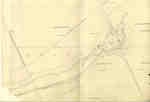
- Survey map of the Second Welland Canal created by the Welland Canal Company showing the township of Crowland as well as the Village of Welland-Merritville. Identified structures associated with the CSurvey map of the Second Welland Canal created by the Welland Canal …
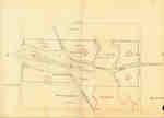
- Survey map of the Second Welland Canal created by the Welland Canal Company showing the border area of the townships of Crowland and Humberstone. Identified structures associated with the Canal incluSurvey map of the Second Welland Canal created by the Welland Canal …
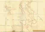
- Survey map of the Second Welland Canal created by the Welland Canal Company showing the area through Humberstone. Identified structures associated with the Canal include Spoil Banks, Towing Path, BacSurvey map of the Second Welland Canal created by the Welland Canal …
- Survey map of the Second Welland Canal created by the Welland Canal Company showing the area through Humberstone Township. Identified structures associated with the Canal are the north and south backSurvey map of the Second Welland Canal created by the Welland Canal …
- Survey map of the Second Welland Canal created by the Welland Canal Company showing the areas in and around Petersburg and Humberstone. Identified structures associated with the Canal include North aSurvey map of the Second Welland Canal created by the Welland Canal …
- Survey map of the Second Welland Canal created by the Welland Canal Company showing the canal in Thorold South. Identified structures associated with the Canal include the Little Deep Cut and the towSurvey map of the Second Welland Canal created by the Welland Canal …
- Survey map of the Second Welland Canal created by the Welland Canal Company showing the Back Water bodies in Thorold Township. The surveyors' measurements and notes can be seen in red and black ink aSurvey map of the Second Welland Canal created by the Welland Canal …
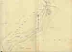
- Survey map of the Second Welland Canal created by the Welland Canal Company showing the canal in Thorold Township. Identified structures associated with the Canal include the towing path. The surveyoSurvey map of the Second Welland Canal created by the Welland Canal …
- Survey map of the Second Welland Canal created by the Welland Canal Company showing the canal in Thorold Township. Identified structures associated with the Canal include the towing path. The surveyoSurvey map of the Second Welland Canal created by the Welland Canal …
- Survey map of the Second Welland Canal created by the Welland Canal Company showing the canal in Thorold Township. Identified structures associated with the Canal include the towing path. The surveyoSurvey map of the Second Welland Canal created by the Welland Canal …
- Survey map of the Second Welland Canal created by the Welland Canal Company showing the canal in Thorold Township northwest of Allanburgh. Identified structures associated with the Canal include theSurvey map of the Second Welland Canal created by the Welland Canal …
- Survey map of the Second Welland Canal created by the Welland Canal Company showing the area between the Townships of Grantham and Louth. Identified structures associated with the Canal include the fSurvey map of the Second Welland Canal created by the Welland Canal …
- Survey map of the Second Welland Canal created by the Welland Canal Company along the western edge of the Town of St. Catharines. Although not labelled, the Second Welland Canal can be seen running tSurvey map of the Second Welland Canal created by the Welland Canal …
- Survey map and description of Nathan Pawling's land created by The Welland Canal Company. Included is a written description of the land along with a drawing of the land. Noteable features include; thSurvey map and description of Nathan Pawling's land created by The Welland …
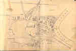
- Survey map of the Second Welland Canal created by the Welland Canal Company showing Port Robinson and the canal to Chippewa Creek. The surveyors' measurements and notes can be seen in red and black iSurvey map of the Second Welland Canal created by the Welland Canal …
- The current spelling of Chippewa Creek is Chippawa. Although it not possible to make out the entire name of the H. W. Timms hotel located at Front and Bridge Street on the map itself, it was discoverThe current spelling of Chippewa Creek is Chippawa. Although it not possible …
- Survey map of the Second Welland Canal created by the Welland Canal Company showing the border area of the townships of Crowland and Humberstone, as well as the Village of Junction. Identified structSurvey map of the Second Welland Canal created by the Welland Canal …
- Survey map of the Second Welland Canal created by the Welland Canal Company showing the border area of the townships of Crowland and Humberstone, as well as the Village of Junction. Identified structSurvey map of the Second Welland Canal created by the Welland Canal …
- Survey map of the Second Welland Canal created by the Welland Canal Company showing a portion of the Grantham Township sometimes referred to as the Welland Vale. Identified structures associated withSurvey map of the Second Welland Canal created by the Welland Canal …
Brock Images are created and maintained by the Special Collections and Archives, James A. Gibson Library, Brock University.


