Results
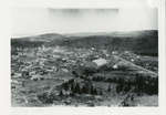
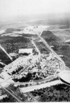
- Photograph shows an aerial view of Schreiber looking westward.Photograph shows an aerial view of Schreiber looking westward.
- Photograph shows an aerial view of Schreiber looking eastward.Photograph shows an aerial view of Schreiber looking eastward.
- A close view of Schreiber, Ontario. Notice there is no area, and no paving in 1933.A close view of Schreiber, Ontario. Notice there is no area, and …
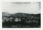
- Black and white photograph of an aerial view of Schreiber. Running through the town is the Canadian Pacific Railway.Black and white photograph of an aerial view of Schreiber. Running through …
- Framed black and white panoramic photograph of Schreiber. Frame is loose and damaged.Framed black and white panoramic photograph of Schreiber. Frame is loose and …
- Framed black and white photograph of the railway running through Schreiber. Entered according to the act of Parliament of Canada, in the year 1907 by the Aerial Company at the Department of AgricultuFramed black and white photograph of the railway running through Schreiber. Entered …
- Framed black and white aerial photograph of Schreiber.Framed black and white aerial photograph of Schreiber.
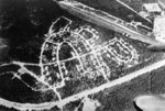
- A birds eye view at the town of Terrace Bay. Year is unknown.A birds eye view at the town of Terrace Bay. Year is …
- Photograph is an aerial view of Schreiber during the First World War.Photograph is an aerial view of Schreiber during the First World War.
- Photograph is an close aerial view of Schreiber during the First World War.Photograph is an close aerial view of Schreiber during the First World …
- This name is stamped on the postcard but unclear as to what their relation to the image is: Northland Specialty Co. Box 232 Thunder Bay, Ontario P7C 4V8This name is stamped on the postcard but unclear as to what …
- Black and white photograph of Schreiber showing the railroad in the centre of town.Black and white photograph of Schreiber showing the railroad in the centre …
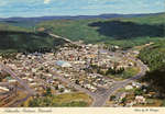
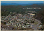
- A post card of an aerial view of Schreiber, Ontario.A post card of an aerial view of Schreiber, Ontario.
- Along The Lake Superior Famous Circle Route. Schreiber is located on the north shore of Lake Superior, along Canada Highway 17. Canadian segment of the Lake Superior Route which completely encirclesAlong The Lake Superior Famous Circle Route. Schreiber is located on the …
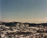
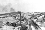
- A winter view of Schreiber taking from the hills that surround the town.A winter view of Schreiber taking from the hills that surround the …
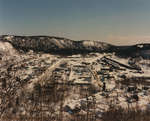
- A view of Schreiber from the hills, from a different angle.A view of Schreiber from the hills, from a different angle.
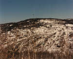
- A view of Schreiber in the winter, from another angle.A view of Schreiber in the winter, from another angle.
- An aerial view of south camp, Terrace Bay, Ontario.An aerial view of south camp, Terrace Bay, Ontario.
- An aerial view of Jackfish coal terminal located outside of Terrace Bay, Ontario. During, the 17th, 18th, and 19th centuries a heavy traffic of French and later English fur traders, past through theAn aerial view of Jackfish coal terminal located outside of Terrace Bay, …
- A view of the village of Jackfish Harbour as well as the coal chutes. This photo was taken at the end of the steam locomotive era in the late 1940's.A view of the village of Jackfish Harbour as well as the …


