Results
- This church was located at 45 Cassels Road East at the south west corner of Cassels Road and Church Street. It was built as a Bible Christian Church in 1876. From 1884 to 1916 it was a Baptist ChurchThis church was located at 45 Cassels Road East at the south …
- This church was located at 45 Cassels Road East at the south west corner of Cassels Road and Church Street. It was built as a Bible Christian Church in 1876. From 1884 to 1916 it was a Baptist ChurchThis church was located at 45 Cassels Road East at the south …
- This church was located at 15 Church Street on the east side of Church Street south of Mill Street (Cassels Road). It was built in 1862 and demolished in the 1920s after union with the Methodist ChurThis church was located at 15 Church Street on the east side …
- This school was located on Baldwin Street. It was built in 1923 on the south east corner of Highway 12 and Winchester Road. It was officially opened on January 30, 1924 and closed in 1972. It was demThis school was located on Baldwin Street. It was built in 1923 …
- This church was located at 15 Church Street on the east side of Church Street south of Mill Street (Cassels Road). It was built in 1862 and demolished in the 1920s after union with the Methodist ChurThis church was located at 15 Church Street on the east side …
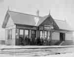
- Brooklin Railway Station was located at 93 Winchester Road East. It was located at the south west corner of Anderson Street and Winchester Road on a railway that stretched from Port Whitby to Port PeBrooklin Railway Station was located at 93 Winchester Road East. It was …
- Three black and white photographic postcards of Brooklin. The picture to the left is the Canadian Northern Railway Station and water tower south of Brooklin. At centre is a post card of the St. ThomaThree black and white photographic postcards of Brooklin. The picture to the …
- The houses in this photograh from left to right were owned by Dr. James Moore, Uriah Jones, Bill Blight.Whitby’s house numbering system was provided by Rev. Dr. James Roy Van Wyck (1877-1941), a retiThe houses in this photograh from left to right were owned by …
- The houses in this photograh from left to right were owned by Dr. James Moore, Uriah Jones, Bill Blight.Whitby’s house numbering system was provided by Rev. Dr. James Roy Van Wyck (1877-1941), a retiThe houses in this photograh from left to right were owned by …
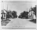
- A black and white photograph of Baldwin Street looking north from Roebuck Street. The frame building at left is the Dominion Bank. The frame building at right on the north east corner of Baldwin StreA black and white photograph of Baldwin Street looking north from Roebuck …
- A black and white photograph of Baldwin Street looking north from Roebuck Street. The frame building at right on the north east corner of Baldwin Street and Roebuck Street is the Brooklin Hardware StA black and white photograph of Baldwin Street looking north from Roebuck …
- A black and white photograph of Baldwin Street looking south in Brooklin. At the left side of the photograph a car can be seen parked at the side of the street. The furthest building that can be seenA black and white photograph of Baldwin Street looking south in Brooklin. …
- Brooklin Community Park was located on Winchester Road East. This photograph looks north from the entrance of the park on the south side of Winchester Road opposite Simcoe Street. The stone gates werBrooklin Community Park was located on Winchester Road East. This photograph looks …
- Grass Park is located at 41 Baldwin Street. It is a triangle shaped piece of land bounded by Roebuck Street, Baldwin Street and Mill Street (Cassels Road). This view is looking west from the intersecGrass Park is located at 41 Baldwin Street. It is a triangle …
- The Brooklin Presbyterian Church was built in 1862 and demolished in 1926. The Baptist Church was built in 1876 and was later used as a township hall and community centre.The Brooklin Presbyterian Church was built in 1862 and demolished in 1926. …
- A black and white class photograph of motorcycles being drive down Baldwin Street. The motorcycles are part of the Brooklin Spring Fair parade.A black and white class photograph of motorcycles being drive down Baldwin …
- Whitby township Hall opened in 1922 and served until 1965 in the former Bible Christian Church at the south west corner of church Street and Cassels Road. The building was built in 1876 as a Bible ChWhitby township Hall opened in 1922 and served until 1965 in the …
- This park is located on Winchester Road East opposite Simcoe Street. The stone gates were installed in 1921.This park is located on Winchester Road East opposite Simcoe Street. The …
- This house was located at 33 Queen Street at the north east corner of Cassels Road and Queen Street. The house was built in 1857 for Bishop Philander Smith of the Methodist Episcopal Church of CanadaThis house was located at 33 Queen Street at the north east …
- This station on the Port Whitby and Port Perry Railway was located at 93 Winchester Road East at the south west corner of Winchester Road and Anderson Streets. It was built in 1895 and destroyed by fThis station on the Port Whitby and Port Perry Railway was located …


