Results
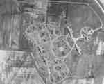
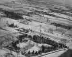
- A black and white aerial photograph of the Whitby Military Convalescent Hospital with the old John Smith farm and the powerhouse in the foreground. In the background is the Lynde Creek.A black and white aerial photograph of the Whitby Military Convalescent Hospital …
- From 1917-1919 this facility was the Military Convalescent Hospital.From 1917-1919 this facility was the Military Convalescent Hospital.
- From: "The Hospitals of Ontario, A Short History, Hospital Divisions." Ontario Department of Health, 1934. Page 266.From: "The Hospitals of Ontario, A Short History, Hospital Divisions." Ontario Department …
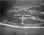
- A black and white aerial photograph of the Ontario Hospital Whitby looking north from Lake Ontario.A black and white aerial photograph of the Ontario Hospital Whitby looking …
- A black and white aerial photograph of the Ontario Hospital Whitby looking north from Lake Ontario.A black and white aerial photograph of the Ontario Hospital Whitby looking …
- Photo from: Vox Collegii, School Yearbook, 1941Photo from: Vox Collegii, School Yearbook, 1941
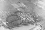
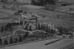
- This is a black and white aerial photograph of the Ontario Ladies' College buildings and property.This is a black and white aerial photograph of the Ontario Ladies' …
- This is a black and white aerial photograph of the Ontario Ladies' College buildings and property.This is a black and white aerial photograph of the Ontario Ladies' …
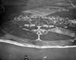
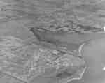
- A black and white aerial photograph of the Ontario Hospital Whitby and Whitby Harbour.A black and white aerial photograph of the Ontario Hospital Whitby and …
- A black and white aerial photograph of Ontario Hospital Whitby and the Whitby Harbour.A black and white aerial photograph of Ontario Hospital Whitby and the …
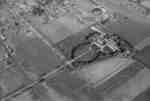
- This is a black and white aerial photograph of the Ontario Ladies' College. This picture shows the College and the farm which was once part of the college. The view looks north-east. Ontario Ladies'This is a black and white aerial photograph of the Ontario Ladies' …
- Ontario Ladies' College is now known as Trafalgar Castle School, and is located at 401 Reynolds Street.Ontario Ladies' College is now known as Trafalgar Castle School, and is …
- A colour slide of an aerial view of Cochrane Street looking north in Whitby, Ontario.A colour slide of an aerial view of Cochrane Street looking north …
- A colour slide of an aerial view of Cochrane Street looking north in Whitby, Ontario. This view is of Cochrane Street south of Bonacord Avenue.A colour slide of an aerial view of Cochrane Street looking north …
- A colour slide of an aerial view of Cochrane Street looking north in Whitby, Ontario. This view is of Cochrane Street at Bonacord Avenue.A colour slide of an aerial view of Cochrane Street looking north …
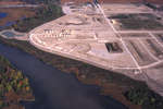
- A colour slide of an aerial view of the subdivision of Whitby Shores under construction. Lynde Shores Conservation area is on the left side of the photograph.A colour slide of an aerial view of the subdivision of Whitby …
- A colour slide of an aerial view of Whitby looking north. In this view the subdivision of West Lynde is in the foreground. Highway 2 (Dundas Street) is in the centre of the photograph.A colour slide of an aerial view of Whitby looking north. In …
- A colour slide of an aerial view of Whitby looking north. In this view the intersection of Cochrane Street and Highway 2 (Dundas Street) is on the right side of the photograph.A colour slide of an aerial view of Whitby looking north. In …
- A colour slide of an aerial view of Whitby looking south. In the centre of the photograph is the subdivision of Whitby Shores under construction. Lynde Creek is to the left of the photograph.A colour slide of an aerial view of Whitby looking south. In …
- A colour slide of an aerial view of Whitby looking east. In the centre of the photograph is the subdivision of Whitby Shores under construction. Lynde Creek and Lake Ontario are in the foreground.A colour slide of an aerial view of Whitby looking east. In …


