Results
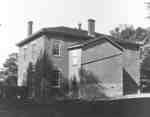
- The Whitby Collegiate Institute was built in 1873 and was located on the south side of Colborne Street between King and Centre Streets. The school was demolished in 1975-1976.The Whitby Collegiate Institute was built in 1873 and was located on …
- The Whitby Collegiate Institute was built in 1873 and was located on the south side of Colborne Street between King and Centre Streets. The school was demolished in 1975-1976.The Whitby Collegiate Institute was built in 1873 and was located on …
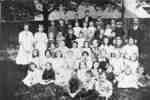
- Dufferin Street School was built in 1851 on the west side of Dufferin Street south of Victoria Street. It served as the school for Port Whitby from 1852-1915 when it was replaced by Brock Street SchoDufferin Street School was built in 1851 on the west side of …
- Dundas Street School, also known as the model school, was built in 1875 on the north side of Dundas Street west of Garden Street. It was demolished in the early 1960s but additions from the 1950s remDundas Street School, also known as the model school, was built in …
- Henry Street School was built in 1854 on the block bounded by King, Dunlop, Henry, and Gilbert Streets and is now occupied by R.A. Sennett Public School. The school, which faced Henry Street, was desHenry Street School was built in 1854 on the block bounded by …
- Dryden School, so called because it was on the James Dryden farm, was officially known as Union School Section No.6 and it combined Whitby and East Whitby Townships. The school house was built in 188Dryden School, so called because it was on the James Dryden farm, …
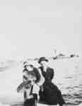
- Black and white negative of a photograph of an image showing William Barton and an unidentified woman at Port Whitby. View looking east from Whitby harbour shows the waterworks pumping station in theBlack and white negative of a photograph of an image showing William …
- The Chester Draper grain elevator was built in 1867 and demolished in 1916. It was located at the east side of the slip at the harbour.The Chester Draper grain elevator was built in 1867 and demolished in …
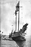
- The Maple Leaf was owned by Captain Richard Goldring (1859-1945) of Port Whitby. He operated the schooner until 1911 when he became a store keeper at Port Whitby.The Maple Leaf was owned by Captain Richard Goldring (1859-1945) of Port …
- Captain Richard Goldring (1859-1945)was the lighthouse keeper at Whitby harbour. He was also the captain of the Maple Leaf schooner until 1911 when he became a store keeper at Port Whitby.Captain Richard Goldring (1859-1945)was the lighthouse keeper at Whitby harbour. He was …
- Black and white negative of a photograph showing two unidentified young women in a rowboat on Whitby harbour. They are not far from the east pier (right side of image). The coal shed and a schooner aBlack and white negative of a photograph showing two unidentified young women …
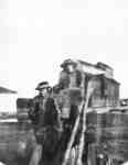
- Black and white negative of a photograph showing an image of a group of four people standing on the new concrete docks that were built in 1913-1914 at Whitby harbour. The waterworks pumping station aBlack and white negative of a photograph showing an image of a …
- Black and white negative of a photograph showing an image of Port Whitby in winter. View looking west from the home of Richard Goldring (1750 Dufferin Street). The buildings of the Ontario Hospital aBlack and white negative of a photograph showing an image of Port …
- The coal sheds were located east of the slip at Whitby harbor. They were owned by Richard Goldring and E.R. Blow.The coal sheds were located east of the slip at Whitby harbor. …
- The coal sheds were located east of the slip at Whitby harbor. They were owned by Richard Goldring and E.R. Blow.The coal sheds were located east of the slip at Whitby harbor. …
- Black and white negative of a photograph of a schooner in Lake Ontario. The unidentified boat is moored off a beach near Whitby harbour.Black and white negative of a photograph of a schooner in Lake …
- The Goldring store was operated by the Goldring family from 1911 until it was demolished in 1967. It was located at 1506 Brock Street South, Port Whitby.The Goldring store was operated by the Goldring family from 1911 until …
- The National Hotel was located at the north-east corner of Brock and Water Streets, opposite the slip at the harbour. It was built before 1857 and closed in the 1880s. The hotel was demolished sometiThe National Hotel was located at the north-east corner of Brock and …
- Black and white negative of a photograph showing an image of Port Whitby. View looking north-east across the marsh from the Pringle Creek bridge at Brock Street. At left is the Charles Goldring homeBlack and white negative of a photograph showing an image of Port …
- The waterworks pumping station was built in 1904 on the lakeshore between Whitby Harbour and Heydenshore Park, east of the harbour. An additional pump house was built to the east of this building inThe waterworks pumping station was built in 1904 on the lakeshore between …


