Fire Insurance Map 1908 - 1913 Legend
Description
- Media Type
- Image
- Item Type
- Maps
- Description
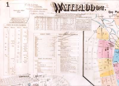
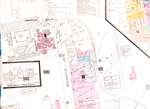
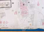
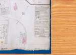
- Fire Insurance map of the main business district of Waterloo. Includes a street index, and index to businesses, public buildings, churches and railway stations. Includes extensive detail on the Globe Furniture Company site and the Mueller Cooperage site.
- Notes
- 1908 map updated to 1913.
See detail photographs for enhanced view of the map.
- Date of Original
- 1913
- Date Of Event
- 1913
- Dimensions
-
Width: 51 cm
Height: 30 cm
- Image Dimensions
-
Image Width: 51cm
Image Height: 30cm
- Subject(s)
- Local identifier
- Local History Room, Maps
- Collection
- Fire Insurance Maps
- Language of Item
- English
- Geographic Coverage
-
-
Ontario, Canada
Latitude: 43.465161 Longitude: -80.522296
-
- Copyright Statement
- Copyright has expired according to Canadian law. No restrictions on use.
- Contact
- Waterloo Public LibraryEmail:askus@wpl.ca
Website:
Agency street/mail address:35 Albert Street, Waterloo, Ontario, Canada, N2L 5E2