Fire Insurance Map, 1908 - 1913, Map 4
Description
- Media Type
- Image
- Item Type
- Maps
- Description
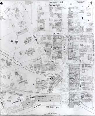
- Fire Insurance map of a section of central Uptown Waterloo. Princess Street to the north, Weaver (later Willis Way) Street to the south, Caroline Street to the west and Queen (later Regina) Street to the east.
Note some of the larger businesses such as Waterloo Manufacturing Company and Snider Flour Mill, also the town hall, fire station and market on Albert Street; bowling alley and Acadian Club; Roschman Button Factory; Dominion Express and Telegraph Office; a moving picture theatre (Princess Theatre?); Bank of Toronto; Dominion Life offices; Market Hotel; Commercial Hotel; Waterloo Mutual Fire Insurance Company offices; Molson's Bank; Waterloo Glove Manufacturing Company and other small businesses. - Notes
- 1908 map updated to 1913.
Duke Street later became Dupont Street.
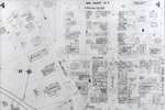
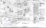
See Detail images for closer view of map. - Date of Original
- 1913
- Date Of Event
- 1913
- Dimensions
-
Width: 20
Height: 25
- Image Dimensions
-
Image Width: 20
Image Height: 25
- Subject(s)
- Fire insurance maps
Waterloo Glove Manufacturing Company Limited (Waterloo, Ont.)
Acadian Club (Waterloo, Ont.)
Albert Street (Waterloo, Ont.)
Erb Street (Waterloo, Ont.)
Queen Street (Waterloo, Ont.)
Regina Street (Waterloo, Ont.)
King Street (Waterloo, Ont.)
Roschman Button Factory (Waterloo, Ont.)
Waterloo Fire Department (Waterloo, Ont.)
Waterloo Manufacturing Company (Waterloo, Ont.)
Bank of Toronto (Waterloo, Ont.)
Commercial Hotel (Waterloo, Ont.)
Molson's Bank (Waterloo, Ont.)
Princess Theatre (Waterloo, Ont.)
Market Hotel (Waterloo, Ont.)
Farmers' Market (Waterloo, Ont.)
Snider Flour Mill (Waterloo, Ont.)
Princess Street (Waterloo, Ont.)
Duke Street (Waterloo, Ont.)
Dupont Street (Waterloo, Ont.) - Local identifier
- Local History Room Maps
- Collection
- Fire Insurance Maps
- Language of Item
- English
- Geographic Coverage
-
-
Ontario, Canada
Latitude: 43.465083 Longitude: -80.522404
-
- Copyright Statement
- Copyright has expired according to Canadian law. No restrictions on use.
- Contact
- Waterloo Public LibraryEmail:askus@wpl.ca
Website:
Agency street/mail address:35 Albert Street, Waterloo, Ontario, Canada, N2L 5E2