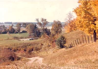
Devil's Hill, Waterloo, Ontario
Description
- Media Type
- Image
- Item Type
- Photographs
- Description
- View of the end of McDougall Road between Keats Way and Shakespeare Drive. Also known as Devil's Hill.
- Date of Original
- [between 1940 and 1950]
- Date Of Event
- [between 1940 and 1950]
- Dimensions
-
Width: 18 cm
Height: 13 cm
- Image Dimensions
-
Image Width: 18cm
Image Height: 13cm
- Subject(s)
- Local identifier
- A-5-6
- Language of Item
- English
- Geographic Coverage
-
-
Ontario, Canada
Latitude: 43.462887 Longitude: -80.546522
-
- Copyright Statement
- Copyright has expired according to Canadian law. No restrictions on use.
- Contact
- Waterloo Public LibraryEmail:askus@wpl.ca
Website:
Agency street/mail address:35 Albert Street, Waterloo, Ontario, Canada, N2L 5E2


