Results
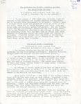
- Four page history on the Grand Trunk Railway. This document focuses mainly on the impact of the railway on the Sundridge area. It covers the export and import of farm goods and how the the local busiFour page history on the Grand Trunk Railway. This document focuses mainly …
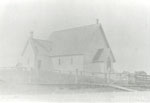
- This picture may have been originally taken by the Lily Faulkner StudioThis picture may have been originally taken by the Lily Faulkner Studio
- The image is faded and is likely a copy of an earlier photograph.The image is faded and is likely a copy of an earlier …
- Fifty-six page booklet entitled "Sundridge Centennial: A Tribute to the Village of Sundridge." The booklet has photographs of the history of Sundridge and stories of the village's history. There areFifty-six page booklet entitled "Sundridge Centennial: A Tribute to the Village of …
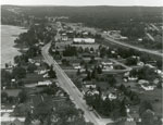
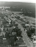
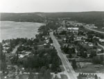
- Black and white aerial photograph of Sundridge Ontario during the 1960s. Lake Bernard is on the left of the photograph. In the middle of the image is the Main Street and Highway 11 is on the right siBlack and white aerial photograph of Sundridge Ontario during the 1960s. Lake …
- Black and white aerial photograph of Sundridge Ontario during the 1960s. A small portion of Lake Bernard can be seen in the upper left hand portion of the image. Hwy 11 can be seen on the right handBlack and white aerial photograph of Sundridge Ontario during the 1960s. A …
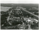
- Black and white aerial photograph of Sundridge during the 1960s. Highway 11 is on the right side of the image, and the main street of Sundridge is the prominent road on the left side of the photograpBlack and white aerial photograph of Sundridge during the 1960s. Highway 11 …
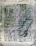
- The maps were on two pieces of 8.5" x 11" paper which were stitched together with Photoshop ElementsThe maps were on two pieces of 8.5" x 11" paper which …
- Photocopy of an early concession map for Strong Township. The township is divided into 14 x 30 plots. Lake Bernard is still Stony Lake at this time. Pool Lake and Lake Wallace are also shown. The maiPhotocopy of an early concession map for Strong Township. The township is …
- A copy of the original founding document for Sundridge. The report was compiled by the Honourable Commissioner of Crown Lands of Ontario. It details the soils, the roads and trees. Later it goes on tA copy of the original founding document for Sundridge. The report was …
- This article originally appeared in the "North Bay Nugget."This article originally appeared in the "North Bay Nugget."
- Black and white aerial photograph of Sundridge and Lake Bernard. In the middle is the Main Street and Highway 11.Black and white aerial photograph of Sundridge and Lake Bernard. In the …
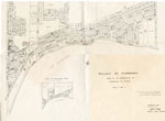
- Map of the village of Sundridge 1957. It includes all the main streets and secondary streets of Sundridge. The map shows the deed numbers of all the properties in the village.Map of the village of Sundridge 1957. It includes all the main …
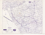
- Map of the district of Parry Sound by A. H. McKee Land & Resort Sales Co. The map was created to show vacation property in the area for sale. The ink on the map is purple.Map of the district of Parry Sound by A. H. McKee Land …
- Its comes from page 168 of the directory.Its comes from page 168 of the directory.
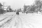
- Black and white photograph of a horse-drawn sled being pulled along the middle of the snow covered Main Street in Sundridge. The street is lined with houses. There are also utility poles on either siBlack and white photograph of a horse-drawn sled being pulled along the …
- Seven page history of the local United Church's 100th anniversary. This short history includes a list of the church's past ministers, a history of the church in Sundridge, and information on the churSeven page history of the local United Church's 100th anniversary. This short …
- Two page excerpt from God's Country. The excerpt focuses on the Methodist Church in Sundridge. A lot of the history of the Methodist Church has been lost. The records of the church don't start untilTwo page excerpt from God's Country. The excerpt focuses on the Methodist …
- There's a small rip on the right side of the clipping.There's a small rip on the right side of the clipping.
- Text document on the History of Sundridge. This history was written by Sundridge resident Lucy Rennie. It covers the first European families in the area. It also discuses the shops built in the area,Text document on the History of Sundridge. This history was written by …


