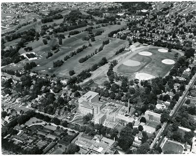
LH0630 Aerial View of Oshawa General Hospital and Alexandra Park
Description
- Media Type
- Image
- Item Type
- Photographs
- Description
- Visible in the image are Parkwood Estate, Oshawa General Hospital, Alexandra Park, Oshawa Golf Course. Park Road can be seen in the top left, Rossland Road at the top and Simcoe Street on the far right.
- Date of Original
- September, 1962
- Subject(s)
- Local identifier
- LH0630
- Geographic Coverage
-
-
Ontario, Canada
Latitude: 43.90012 Longitude: -78.84957
-
- Creative Commons licence
 [more details]
- Copyright Statement
- Public domain: Copyright has expired according to Canadian law. No restrictions on use.
- Location of Original
- PHOTO GPC B-008 000484
- Terms of Use
- Please acknowledge source as Oshawa Public Libraries. Thank You.
- Contact
- Oshawa Public LibrariesEmail:nadams@oshawalibrary.on.ca
Website:
Agency street/mail address:
Nicole Adams, Local History and Genealogy Librarian
65 Bagot Street
Oshawa, ON L1H 1N2
905-579-6111 EXT 5253