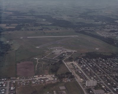
Aerial Photo of Oshawa Airport (colour)
Description
- Media Type
- Image
- Item Type
- Photographs
- Description
- Colour aerial photo shot facing north of area just south of the Oshawa Airport. Ferndale Street is still under construction, and Fairglent Avenue hasn't been developed yet (first appears in city directories in 1976).
- Dimensions
-
Width: 25.5 cm
Height: 20 cm
- Subject(s)
- Local identifier
- LH2709
- Language of Item
- English
- Copyright Statement
- Protected by copyright: Uses other than research or private study require the permission of the rightsholder(s). Responsibility for obtaining permissions and for any use rests exclusively with the user.
- Copyright Date
- 1976
- Terms of Use
- please credit Oshawa Public Libraries, Local History Collection
- Contact
- Oshawa Public LibrariesEmail:nadams@oshawalibrary.on.ca
Website:
Agency street/mail address:
Nicole Adams, Local History and Genealogy Librarian
65 Bagot Street
Oshawa, ON L1H 1N2
905-579-6111 EXT 5253


