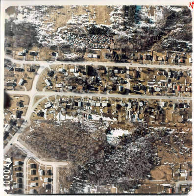
Aerial photograph
Description
- Media Type
- Image
- Item Type
- Photographs
- Description
- Aerial photograph of Orillia. Top road is Mary Street and the road running through the middle of the picture parallel to it is Mississauga Street West which on the left side of the picture turns left and downward and exit the picture on the left side near the bottom.
- Dimensions
-
Width: 20
Height: 20
- Subject(s)
- Local identifier
- OR_1881
- Collection
- Orilliana
- Geographic Coverage
-
-
Ontario, Canada
Latitude: 44.60868 Longitude: -79.42068
-
- Copyright Statement
- Copyright status unknown. Responsibility for determining the copyright status and any use rests exclusively with the user.
- Contact
- Orillia Public Library


