Results
We found
15814
matching items
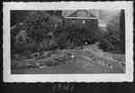
- The Director's Residence of the Horticultural Experimental Station. This building was built in either 1908 or 1909. In 1955 this building was remodelled for use by Agricultural Extension Services.The Director's Residence of the Horticultural Experimental Station. This building was built …
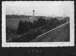
- We speculate that Kenneth had climbed up the water tower to take this picture. Experimental FarmWe speculate that Kenneth had climbed up the water tower to take …
- In the foreground are fields belonging to the Horticultural Experimental Station (Experimental Farm). Victoria Ave would be on the extreme right of the image. We speculate that Kenneth Moyer had climIn the foreground are fields belonging to the Horticultural Experimental Station (Experimental …
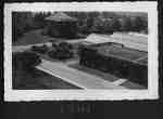
- It appears that Kenneth Moyer is on the roof of the Administration building.It appears that Kenneth Moyer is on the roof of the Administration …
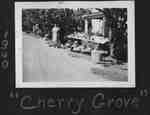
- Gretta Moyer (Mrs. Kenneth Moyer (nee Miller) stands next to the fruit stand. The road on the left is Highway 8 (Reg. Rd. 81). The Moyer's ran Cherry Grove Camp. The property was on the norht side ofGretta Moyer (Mrs. Kenneth Moyer (nee Miller) stands next to the fruit …
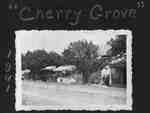
- The fruit stand is on the north side of Highway 8 (Reg. Rd 81). It was located just east of Rittenhouse Rd. in Vineland. On the right is the home of Kenneth and Gretta Moyer who ran the fruit market.The fruit stand is on the north side of Highway 8 (Reg. …
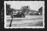
- The barn on the right was dismantled and moved in 2008. The road in the front of the image is Highway 8 (Reg. Rd. 81). Cherry Grove Camp was owned by Elmon Moyer and was taken over by his son KennethThe barn on the right was dismantled and moved in 2008. The …
- Gretta Moyer (nee Miller) is in front of the fruit stand. The house on the right is her home (Kenneth Moyer). The road at the bottom of the image is Highway 8 (Reg. Rd. 81). The Moyers also ran CherrGretta Moyer (nee Miller) is in front of the fruit stand. The …
- The flag appears to be the Union Jack.The flag appears to be the Union Jack.
- Moses F. Rittenhouse paid for this community building.Moses F. Rittenhouse paid for this community building.
- This dirt road was replaced by the Queen Elizabeth Way in 1939. At the time of this picture, the area was a summer vacation spot. This location is probably where the Beacon Motor Inn now stands.This dirt road was replaced by the Queen Elizabeth Way in 1939. …
- The Jordan Harbour Company, formed in the 1880s, offered an alternative shipping method to railroads for farmers to get their goods to market in Toronto.The Jordan Harbour Company, formed in the 1880s, offered an alternative shipping …
- Presumably, this picture was taken from Lake Ontario looking toward Jordan Harbour. The bridge was replaced in 1939 by the Queen Elizabeth Way. The Jordan Harbour Company was started in the 1880s asPresumably, this picture was taken from Lake Ontario looking toward Jordan Harbour. …
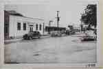
- A view of downtown Vineland, looking east from the south west corner of the intersetion of Victoria Ave (Reg. Rd 24) and Highway 8 (Reg. Rd. 81). On the left is the Imperial Bank of Canada. The signA view of downtown Vineland, looking east from the south west corner …
- Victoria Ave (Reg. Rd 24) is at the bottom of the image. Reg. Rd 81 runs across the image. The Imperial Bank of Canada was built on this corner lot in 1910.Victoria Ave (Reg. Rd 24) is at the bottom of the image. …
- This house was about 3 buildings east of the intersection of Reg. Rd 81 (Grimsby Queenston Stone Road) and Reg. Rd 24 (Victoria Ave.) on the south side of Reg. Rd 81. The house has a bay window on thThis house was about 3 buildings east of the intersection of Reg. …
- Victoria Ave. (Reg. Rd. 24) goes off into the distance. On the right, at the bottom, is the corner of Tallman Dr. Moses F. Rittenhouse paid for the installation of sidewalks from Highway 8 (Reg. Rd.Victoria Ave. (Reg. Rd. 24) goes off into the distance. On the …
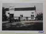
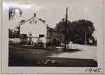
- This building was on the north west corner of Victoria Ave (Reg. Rd. 81) and Highway 8 (Reg. Rd 81). Formerly, Moyer's Garage. From 1905 to 1907 it was the easter terminus of the Hamilton, Grimsby, BThis building was on the north west corner of Victoria Ave (Reg. …
- This building was on the corner of Victoria Ave (Reg. Rd. 81), seen on the right, and Highway 8 (Reg. Rd. 81), seen across the bottom of the picture.This building was on the corner of Victoria Ave (Reg. Rd. 81), …
- Hamilton, Grimsby, Beamsville Electric Railway.Hamilton, Grimsby, Beamsville Electric Railway.


