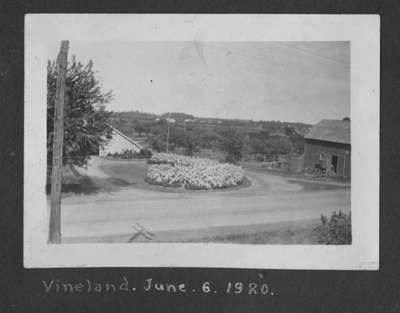
Rittenhouse Road
Description
- Creator
- Kenneth Moyer, Photographer
- Media Type
- Image
- Item Type
- Photographs
- Description
- Looking north across Highway 8 (Reg. Rd. 81) into the intersection with Rittenhouse Rd. There is a flower bed in the center, and on the left is the 'driveway' for the Vineland Mennonite Church. The white building is the driveshed for the church.
- Inscriptions
- Vineland, June 6, 1920
- Date of Original
- 1920
- Date Of Event
- 1920
- Subject(s)
- Geographic Coverage
-
-
Ontario, Canada
Latitude: 43.1539155534108 Longitude: -79.4020128250122
-
- Copyright Statement
- Copyright status unknown. Responsibility for determining the copyright status and any use rests exclusively with the user.
- Contact
- Lincoln Pelham Public LibraryEmail:admin@lppl.ca
Website:
Agency street/mail address:4080 John Charles Blvd.,
Vineland, Ontario L0R 2C0


