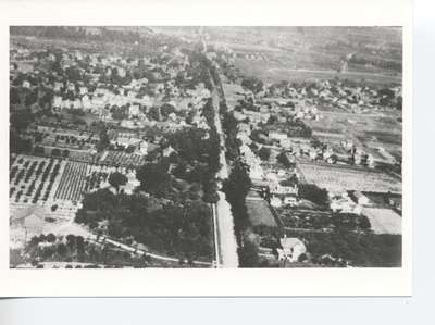
Aerial View of Beamsville
Description
- Media Type
- Image
- Item Type
- Photographs
- Description
- A view of Beamsville looking west along the "Grimsby Queenston Stone Road" (Reg. Rd. 81). Senator Gibson's home can be seen near the lower right corner. The race track for the Fairgrounds can be seen in the upper right corner.
- Notes
- The "new" highschool was built in 1917. It does not appear to be in this photograph. The "School of Aerial Gunnery", run by the British, was located just east of Beamsville in 1918, it may be that a pilot took this photograph.
- Subject(s)
- Geographic Coverage
-
-
Ontario, Canada
Latitude: 43.16681 Longitude: -79.48291
-
- Copyright Statement
- Copyright status unknown. Responsibility for determining the copyright status and any use rests exclusively with the user.
- Contact
- Lincoln Pelham Public LibraryEmail:admin@lppl.ca
Website:
Agency street/mail address:4080 John Charles Blvd.,
Vineland, Ontario L0R 2C0


