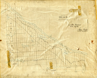
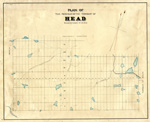
Head Township ca.1859
- Media Type
- Image
- Text
- Collection
- Item Type
- Maps
- Description
- Plan of Head Township dated July 1859.
- Notes
Early surveyors, like William E. Logan, used Rochon micrometer telescopes and targets (disk on a calibrated pole) to measure distance. Each microscope had a different calibration and therefore a different range. The instruments were calibrated against a distance measured with a surveyors chain (also known as Gunter’s chain). One chain had 100 links and was 66 feet (about 20 meters) or 22 yards long.
Sources
William E. Logan (2007). 1845 Survey of the Upper Ottawa Valley. Mercury Series History Paper 54. Charles H. Smith and Ian Dyck (eds.). Gatineau, Quebec: Canadian Museum of Civilization Corporation.
surveyor’s chain. (2010). In Encyclopædia Britannica. Retrieved April 14, 2010, from Encyclopædia Britannica Online: http://www.britannica.com/EBchecked/topic/575448/surveyors-chain
- Inscriptions
- Crown Lands Department Toronto. Signed: A. Russell, Assistant Commissioner.
- Date of Original
- July 1859
- Dimensions
-
Width: 27 cm
Height: 20 cm
- Map Scale
- 40 chains to an inch
- Subject(s)
- Collection
- Township Collection
- Language of Item
- English
- Geographic Coverage
-
-
Ontario, Canada
Latitude: 46.15012 Longitude: -77.86622
-
- Creative Commons licence
 [more details]
- Copyright Statement
- Public domain: Copyright has expired according to Canadian law. No restrictions on use.
- Copyright Date
- 1859
- Contact
- Head, Clara and Maria Public LibraryEmail:hcmhistory@gmail.com


