Results
We found
161642
matching items
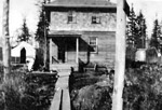
- Photo showing the Ogema Mine camp. In the foreground is the little camp that was used first. Just beyond is the storehouse, and further back is the new camp.Photo showing the Ogema Mine camp. In the foreground is the little …
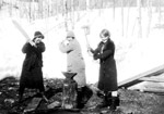
- The three women in this photo are (left to right) Peggy Bohler, Lillian Barrett and Edna Bohler.The three women in this photo are (left to right) Peggy Bohler, …
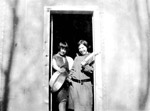
- Photo showing two women, Lillian Bannett and Peggy Bohler standing in the cookhouse doorway.Photo showing two women, Lillian Bannett and Peggy Bohler standing in the …
- Black and white photo of CPR station beside the Dorion Inn that was demolished June 15, 1983.Black and white photo of CPR station beside the Dorion Inn that …
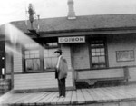
- Black and white photo of Mr. Grant, Station Master for the Canadian Pacific Railway in 1912 in Dorion, Ontario.Black and white photo of Mr. Grant, Station Master for the Canadian …
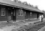
- Black and white photo of Dorion Station, with locomotive beside it. The Canadian Pacific Railway siding at Dorion was built on E1/2 lot 8 concession 3, in the summer of 1907. A flag stop at Dorion siBlack and white photo of Dorion Station, with locomotive beside it. The …
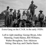
- Extra gang working in CNR early 1920's. Left to Right standing is George Bryan, John Manning, Frank Haines, Bill Williams, Walter Broughton, Tom Atkinson. Left to Right sitting is Dan Kay and CharlieExtra gang working in CNR early 1920's. Left to Right standing is …
- Man standing by one car at Ogema Mine. The Ogema Mine was named after the Native who discovered the mineral occurrence located two kilometers west of Ouimet Canyon Provincial Park in 1890. Mr. JamesMan standing by one car at Ogema Mine. The Ogema Mine was …
- Black and white photo of Frank and Lizzie Hughes and family on velocipede at the CNR Dorion Station where Frank Hughes was station master for eighteen years.Black and white photo of Frank and Lizzie Hughes and family on …
- In 1910 at E1/2 lot 8 concession 3, a permanent station for the CPR was built, with living quarters in the back. Also, as seen in the photo, a second house was built 200 yards from the siding for theIn 1910 at E1/2 lot 8 concession 3, a permanent station for …
- Thunder Bay, Mines-Mining-Dorion-Ogema Mine, OntarioThunder Bay, Mines-Mining-Dorion-Ogema Mine, Ontario
- In 1890, Ogema Mine was located two kilometres west of Quimet Canyon Provincial Park. The company was idle between September 1892 and January 1927. Prices for lead were low, so the mine area was abanIn 1890, Ogema Mine was located two kilometres west of Quimet Canyon …
- The mineral occurrence of Ogema Mine was discovered in 1890. The mining was abruptly stopped due to water difficulties and the mine was sold to Ogema Mining and Smelting Company in 1892. Gold contentThe mineral occurrence of Ogema Mine was discovered in 1890. The mining …
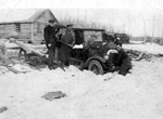
- Photo showing men apparently digging the family vehicle out of the snow. In the background is a log constructed home.Photo showing men apparently digging the family vehicle out of the snow. …
- Due to a steady increase in business, Canadian Pacific Railway built a station to accomodate passengers. They established a permanent station with living quarters in the back and a second house 200 yDue to a steady increase in business, Canadian Pacific Railway built a …
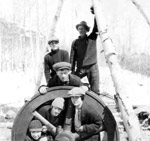
- Unidentified men and women around the compressor fly wheel at Ogema Mine, Dorion Ontario. Work was started in January 1927, camps erected and a road constructed for 6 miles (with Government assistancUnidentified men and women around the compressor fly wheel at Ogema Mine, …
- Photo shows two unidentified men bringing out ore from the mine.Photo shows two unidentified men bringing out ore from the mine.
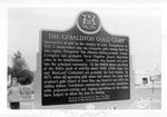
- Photo of the historic Gold Camp Plaque erected in Geraldton on the southwest corner of Main Street and Fourth Avenue South by the Archaeological and Historic Sites Board of Ontario.Photo of the historic Gold Camp Plaque erected in Geraldton on the …
- View looking east down Mine Road to No.2 headframe and mill. Inscription reads 'Hard Rock Gold Mine Ltd'. At the extreme left of photo is the office and residence.View looking east down Mine Road to No.2 headframe and mill. Inscription …
- View looking west up Mine Rd. at No.2 headframe and mill. Inscription reads 'Hard Rock Gold Mine'. In 1936, the company began sinking No.2 shaft on the porphyry outcrop, and erected a mill in 1937. HView looking west up Mine Rd. at No.2 headframe and mill. Inscription …


