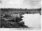
Remains of the York boats used to transport Colonel Garnet Wolseley and his troops from Prince Arthur's Landing (later called Port Arthur) to the Red River Settlement at Fort Garry. Troops followed a water route up the Kaministiquia River to lakes Shebandowan and Kashabowie, Lac des Mille Lacs, and Lake ...
Remains of the York boats used to transport Colonel Garnet Wolseley and ...
Ontario Department of Mines, 1928 Ontario Bureau of Mines Annual Report 1928 Vol.XXXVII, Part 4, p.1-51 Woman Lake ; Narrow Lake ; Confederation Lake ; Means of access to area ; General character of area ; General geology ; Rock types found ; Keewatin rocks ; Economic geology of area ; Topography of area ; ...
Ontario Department of Mines, 1928 Ontario Bureau of Mines Annual Report 1928 Vol.XXXVII, Part 4, p.1-51 Woman ...
Geological Survey of Canada, 1892 Geological Survey of Canada: Report of Progress 1892-93 p.25A-30A Geological surveying ; Lac des Mille Lacs ; Dog Lake ; Port Arthur ; Laurentian gneiss ; Huronian belts ; Greenwater Lake ; Shebandowan Lake ; Waykwabionan Lake ; Greenwood Lake ; Northern Light Lake ; Canoe routes ; Survey routes ...
Geological Survey of Canada, 1892 Geological Survey of Canada: Report of Progress 1892-93 p.25A-30A Geological surveying ; ...
Ontario Department of Mines, 1898 Report of the Bureau of Mines 1898 Vol.VII Part II, p.161-183 Rainy River District ; General geology of area ; Analysis of rocks ; Ignace, ON area ; Indian Lake ; Thirty-Mile Lake ; Bear Lake ; Elephant Lake ; Flying Loon Lake ; English River ; Long Lake ; ...
Ontario Department of Mines, 1898 Report of the Bureau of Mines 1898 Vol.VII Part II, p.161-183 Rainy ...
Geological Survey of Canada, 1890 Geological Survey of Canada: Report of Progress 1890-91 p.1G-76G Lake of the Woods ; Rainy River ; Rainy Lake ; Geological surveys ; Fort Frances, ON ; Lac la Croix ; Maligne River ; Sturgeon Lake ; Keat's Lake ; Port Arthur, ON ; Kahnipiminanikok Lake ; Saganagons Lake ; ...
Geological Survey of Canada, 1890 Geological Survey of Canada: Report of Progress 1890-91 p.1G-76G Lake of the ...
Geological Survey of Canada, 1899 Geological Survey of Canada: Report of Progress 1899 p.7A, 115A-122A Iron Ores ; South-West of Thunder Bay ; Animikie Rocks ; Atikokan District ; Seine River ; Shebandowan ; Ignace ; Rainy River District ; Thunder Bay District ; Fort William ; English River ; Selwyn Lake ; Keewatin rock ...
Geological Survey of Canada, 1899 Geological Survey of Canada: Report of Progress 1899 p.7A, 115A-122A Iron Ores ...
Ontario Department of Mines, 1923 Ontario Bureau of Mines Annual Report Vol.XXXII, Part 3 p.8-22 Lake Nipigon ; Mack Lake ; Cedar Lake ; Mack Sation (train station) ; White Beaver Lake ; Long Lake ; Sand Hill Lake ; Clearwater Lake ; Mountain Portage ; Shell Lake ; Cedar Lake ; Pakashcan Lake ; ...
Ontario Department of Mines, 1923 Ontario Bureau of Mines Annual Report Vol.XXXII, Part 3 p.8-22 Lake Nipigon ...
Ontario Department of Mines, 1920 Ontario Bureau of Mines Annual Report Vol.XXIX, Part 1, p.157-191 Patricia region ; District of Patricia ; Sioux Lookout area ; Lac Seul ; Description of geology of Lac Seul area ; South Cove ; Pine Ridge Post, Hudson's Bay Company ; English River ; Mattawa River ; Shanty Narrows ...
Ontario Department of Mines, 1920 Ontario Bureau of Mines Annual Report Vol.XXIX, Part 1, p.157-191 Patricia region ...
Geological Survey of Canada, 1880 Geological Survey of Canada: Report of Progress 1880-81-82 p.11C-15C Lake Superior ; Lake Winnipeg ; Red River ; Laurentian system ; Huronian system ; Lake of the Woods ; Wabigoon Lake ; Rat Portage (Kenora) ; Three-Fork River ; Eagle Lake ; Vermillion Lake ; Bell Lake ; Shoal Lake ...
Geological Survey of Canada, 1880 Geological Survey of Canada: Report of Progress 1880-81-82 p.11C-15C Lake Superior ; ...
Ontario Department of Mines, 1909 Ontario Bureau of Mines Annual Report Vol.XVIII, Part 1, p.154-162 Iron ranges ; Round Lake ; Mud River (photo) ; Haystack Mountain (photo) ; Nipigon, ON ; Pikitigushi River ; Lake Nipigon ; Map showing iron range north of Round Lake ; Rocks of the Round Lake area ; Pleistocene ...
Ontario Department of Mines, 1909 Ontario Bureau of Mines Annual Report Vol.XVIII, Part 1, p.154-162 Iron ranges ...
Ontario Department of Mines, 1909 Ontario Bureau of Mines Annual Report Vol.XVIII, Part 1, p.163-179 Iron ranges ; Black Sturgeon Lake ; Black Sturgeon River ; Lake Nipigon ; Nipigon, ON ; Mr. Wily of Port Arthur ; Mr. Marks of Port Arthur ; Canoe routes ; Black Bay, Lake Superior ; Diabase cliffs, Black ...
Ontario Department of Mines, 1909 Ontario Bureau of Mines Annual Report Vol.XVIII, Part 1, p.163-179 Iron ranges ...
Ontario Department of Mines, 1909 Ontario Bureau of Mines Annual Report Vol.XVIII, Part 1, p.180-195 Big Iron ; Iron ; English River ; Thunder Bay District ; Rainy River District ; Selwyn Lake ; Selwyn Lake region ; Little Bear Lakes ; Niblock Station ; Yellow Lake ; Greer Lake ; Mining Claims ; Map ...
Ontario Department of Mines, 1909 Ontario Bureau of Mines Annual Report Vol.XVIII, Part 1, p.180-195 Big Iron ...
Ontario Department of Mines, 1908 Ontario Bureau of Mines Annual Report Vol.XVII, Part 1 p.95-135 Thunder Bay District ; Canoe routes ; White Lake ; Kabinakagami Lake ; Quinquaga Lake ; Obakamaga Lake ; Pegutchewan River ; Flint River ; Kemogami River ; English River ; Heron Bay ; Topography of area ; Pic River ...
Ontario Department of Mines, 1908 Ontario Bureau of Mines Annual Report Vol.XVII, Part 1 p.95-135 Thunder Bay ...
Geological Survey of Canada, 1894 Geological Survey of Canada: Report of Progress 1894 p.1F-54F Keewatin ; Berens River ; Red Lake ; English River ; Lac Seul ; Cat Lake ; White River ; Lake Winnipeg ; Trout Lake ; Gull Rock Lake ; Shallow Lake ; Woman Lake ; Elevation of lakes in region ...
Geological Survey of Canada, 1894 Geological Survey of Canada: Report of Progress 1894 p.1F-54F Keewatin ; Berens ...
Geological Survey of Canada, 1908 Geological Survey of Canada: Report of Progress 1908 p.95-96 Lake Nipigon ; Nipigon, ON ; Thunder Bay District ; Iron ranges ; Poplar Lodge ; Area between Black Sturgeon Lake and Nonwatin Lake ; Round Lake ; Mud River ; Caribou Lake ; Marshall lake
Geological Survey of Canada, 1908 Geological Survey of Canada: Report of Progress 1908 p.95-96 Lake Nipigon ; ...
Geological Survey of Canada, 1909 Geological Survey of Canada: Report of Progress 1909 24 pgs Pic River ; Lake Superior ; Topography of area ; Little Pic River ; Pays Plat ; Nipigon, ON ; Nipigon River ; Lake Nipigon ; Middleton, ON ; Rabbit Lake ; Canoe Routes ; Whitefish Lake ; Steel River ...
Geological Survey of Canada, 1909 Geological Survey of Canada: Report of Progress 1909 24 pgs Pic River ...
Geological Survey of Canada, 1872 Geological Survey of Canada: Report of Progress 1872-73 p.8-18 Canoe Routes ; Portages ; Lake Superior ; Thunder Bay ; R. Bell ; Mr. John McIntyre (of Fort William) ; Separation Lake ; Kaministiquia River ; Pigeon River ; Lac Bois Blanc ; Hudson's Bay Co. ; Whitewood Lake ; ...
Geological Survey of Canada, 1872 Geological Survey of Canada: Report of Progress 1872-73 p.8-18 Canoe Routes ; ...
Ontario Department of Mines, 1910 Report of the Bureau of Mines 1910 Vol.XIX Part 1; p.173-193 Lake Savant ; Savant Lake ; Iron Range ; Geological Survey ; History of the iron range ; Geography of area ; Sturgeon River (photo) ; Dog Lake Portage ; Canoe routes ; Dog Lake Portage ; Superior Junction ...
Ontario Department of Mines, 1910 Report of the Bureau of Mines 1910 Vol.XIX Part 1; p.173-193 Lake ...
Ontario Department of Mines, 1916 Report of the Bureau of Mines 1916 Vol.XXV Part 1; p.264-274 Kowkash ; Northeast of Nipigon, ON ; Gold deposits ; Thunder Bay District ; Lake Nipigon ; E.W. King Dodds ; King Dodds claim ; King-Dodds claim ; Early exploration of area ; History of area ; Kowkash Station, ...
Ontario Department of Mines, 1916 Report of the Bureau of Mines 1916 Vol.XXV Part 1; p.264-274 Kowkash ...