Results
- View looking east down Mine Road to No.2 headframe and mill. Inscription reads 'Hard Rock Gold Mine Ltd'. At the extreme left of photo is the office and residence.View looking east down Mine Road to No.2 headframe and mill. Inscription …
- View looking west up Mine Rd. at No.2 headframe and mill. Inscription reads 'Hard Rock Gold Mine'. In 1936, the company began sinking No.2 shaft on the porphyry outcrop, and erected a mill in 1937. HView looking west up Mine Rd. at No.2 headframe and mill. Inscription …
- View looking southeast from the old Bankfield Highway at Magnet Mine. Today, Highway 11 is beyond the buildings shown here. Inscription reads 'Magnet Consolidated Gold Mine.' Magnet Consolidated GoldView looking southeast from the old Bankfield Highway at Magnet Mine. Today, …
- Inscription reads 'Pouring of first Gold Brick at MacLeod Cockshutt Gold Mine, May 20th, 1938'.Inscription reads 'Pouring of first Gold Brick at MacLeod Cockshutt Gold Mine, …
- Inscription reads 'First Gold Brick - Bankfield Consolidated Mine June 12, 1937'. The first brick weighed in at 601.19 ounces. The Bankfield Mine was one of the most modern mills in the gold mining iInscription reads 'First Gold Brick - Bankfield Consolidated Mine June 12, 1937'. …
- Hutchinson Lake Gold Mines Ltd., incorporated in 1935, dug a series of trenches and test pits, but not until 1936 did the company begin it's shaft-sinking operation. The photo shows the site after thHutchinson Lake Gold Mines Ltd., incorporated in 1935, dug a series of …
- View looking west at Tombill mine. Note the water line to a short water tower in the foreground of the photo. Tombill Gold Mines was incorporated in 1935 and shaft-sinking began the following year. BView looking west at Tombill mine. Note the water line to a …
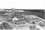
- Elevated view of MacLeod mine looking east towards Hardrock mine. From right to left, the No. 2 headframe of Macleod mine, the No. 2 headframe of Hardrock mine, and barely visible, Hardrock's No.1 heElevated view of MacLeod mine looking east towards Hardrock mine. From right …
- Inscription reads 'Maylac Gold Mine'. Maylac Gold Mines Limited was incorporated in 1946, when it acquired the property of Hutchison Lake Gold Mines Ltd., becoming the ninth gold producer in the GeraInscription reads 'Maylac Gold Mine'. Maylac Gold Mines Limited was incorporated in …
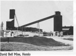
- The David Bell Mine located in Hemlo, Ontario.The David Bell Mine located in Hemlo, Ontario.
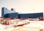
- Construction completed at Hemlo Gold Mines-now Newmont MinesConstruction completed at Hemlo Gold Mines-now Newmont Mines
- George Harmer pouring a gold brick.George Harmer pouring a gold brick.
- Campbell-Red Lake mine produced 926.5 million dollars worth of gold ore by the end of 1984.Campbell-Red Lake mine produced 926.5 million dollars worth of gold ore by …
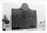
- Photo of the historic Gold Camp Plaque erected in Geraldton on the southwest corner of Main Street and Fourth Avenue South by the Archaeological and Historic Sites Board of Ontario.Photo of the historic Gold Camp Plaque erected in Geraldton on the …
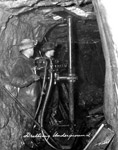
- Photo showing an underground drilling operation of a gold mine.Photo showing an underground drilling operation of a gold mine.
- A winter view of Bankfield Mine looking west. Note the water line running to the water tower serving both Bankfield and Tombill Mines. The Bankfield Gold Mines began shaft-sinking in 1934, and threeA winter view of Bankfield Mine looking west. Note the water line …
- Group of unidentified prospectors, one of them holding a gold brick.Group of unidentified prospectors, one of them holding a gold brick.
- Aerial View looking west towards Wildgoose Lake. The inscription reads 'Air view of Bankfield Consolidated Mine, Tombill Mine, and Jellicoe Mine'. Highway 11 and Bankfield Mine are in the foreground.Aerial View looking west towards Wildgoose Lake. The inscription reads 'Air view …
- Aerial view looking north, along the shoreline of Kenogamisis Lake. Hard Rock Gold Mine was incorporated in 1934 and in 1935 the No.1 shaft was sunk on Discovery Point. Work ceased in 1937 in order tAerial view looking north, along the shoreline of Kenogamisis Lake. Hard Rock …


