Results
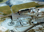
- Mine tailings and disposal., Top right - Pellet Reducing kiln. Round structure is tailing tank. To the right is the crusher buildings.Mine tailings and disposal., Top right - Pellet Reducing kiln. Round structure …
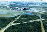
- Building to the right is pellet plant. To the left is the kiln, and in the background is the open pit mine.Building to the right is pellet plant. To the left is the …
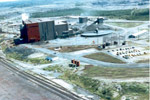
- Big red and grey building is the pellet plant. To the right is the tailings tank and crusher behind it.Big red and grey building is the pellet plant. To the right …
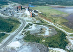
- White building to the right is the kiln. Large dark buildings to the left is pellet plant.White building to the right is the kiln. Large dark buildings to …
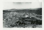
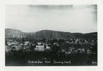
- Photograph shows an aerial view of Schreiber looking westward.Photograph shows an aerial view of Schreiber looking westward.
- Photograph shows an aerial view of Schreiber looking eastward.Photograph shows an aerial view of Schreiber looking eastward.
- A close view of Schreiber, Ontario. Notice there is no area, and no paving in 1933.A close view of Schreiber, Ontario. Notice there is no area, and …
- Black and white photograph of an aerial view of Schreiber. Running through the town is the Canadian Pacific Railway.Black and white photograph of an aerial view of Schreiber. Running through …
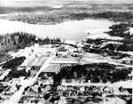
- Aerial View looking west towards Wildgoose Lake. The inscription reads 'Air view of Bankfield Consolidated Mine, Tombill Mine, and Jellicoe Mine'. Highway 11 and Bankfield Mine are in the foreground.Aerial View looking west towards Wildgoose Lake. The inscription reads 'Air view …
- Aerial view looking north, along the shoreline of Kenogamisis Lake. Hard Rock Gold Mine was incorporated in 1934 and in 1935 the No.1 shaft was sunk on Discovery Point. Work ceased in 1937 in order tAerial view looking north, along the shoreline of Kenogamisis Lake. Hard Rock …
- Aerial view looking northeast. Inscription reads 'Elmos Mine'. The name of Elmos is a composite for Ellis and Mosher. In the centre is the headframe site on a tiny island, and to the left is a clusteAerial view looking northeast. Inscription reads 'Elmos Mine'. The name of Elmos …
- Aerial view looking west from Kenogamisis Lake. In the foreground is the No.1 headframe of Hardrock Mine. To the extreme right is Hardrock Townsite. In the centre is No.2 headframe of the Hardrock MiAerial view looking west from Kenogamisis Lake. In the foreground is the …
- Aerial view looking northwest. Inscription reads 'MacLeod Cockshutt Gold Mine showing Hard Rock Gold mine in the foreground, December, 1937.' Upper portion shows the hills on which MacLeod Townsite iAerial view looking northwest. Inscription reads 'MacLeod Cockshutt Gold Mine showing Hard …
- Aerial view looking northeast across Barton Bay. Inscription reads 'Little Long Lac Gold mine'. In the foreground is the clearing for Errington Avenue. It would later be called Arena Road and in 1939Aerial view looking northeast across Barton Bay. Inscription reads 'Little Long Lac …
- Framed black and white panoramic photograph of Schreiber. Frame is loose and damaged.Framed black and white panoramic photograph of Schreiber. Frame is loose and …
- Framed black and white photograph of the railway running through Schreiber. Entered according to the act of Parliament of Canada, in the year 1907 by the Aerial Company at the Department of AgricultuFramed black and white photograph of the railway running through Schreiber. Entered …
- Framed black and white aerial photograph of Schreiber.Framed black and white aerial photograph of Schreiber.
- Cochenour-Williams Mine was located three miles north of Red Lake Ontario. This mine produced 46 million dollars worth of gold in the span from 1939-1971 and was part of the 'Golden Triangle'.Cochenour-Williams Mine was located three miles north of Red Lake Ontario. This …
- An aerial view (looking south to the U.S). of Lac Seul Dam, Ear Falls Generating station on the English River, November 22, 1957.An aerial view (looking south to the U.S). of Lac Seul Dam, …
- Aerial photograph of the Hydro colony of Ear Falls, Ontario 1957. The area was created to house the hydro workers and their families.Aerial photograph of the Hydro colony of Ear Falls, Ontario 1957. The …


