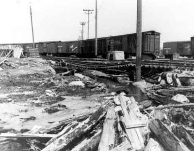
Current River Run-off
Description
- Media Type
- Image
- Item Type
- Photographs
- Description
- Black and white photo of washout where the water rose 3.6 feet above normal over the Current River Dam. This flash flood ruined sections of Highway ll near Orient Bay. Ontario Department of Highways worked through the night to repair a 30 foot section that dug a 6 foot gully across the road. Damage was caused by a torrent of water that came down from nearby rocky hills. This photo shows damage to the rail line.
- Date of Original
- 1957
- Image Dimensions
-
Image Width: 5
Image Height: 3.5
- Subject(s)
- Local identifier
- P729
- Collection
- Thunder Bay Public Library
- Language of Item
- English
- Geographic Coverage
-
-
Ontario, Canada
Latitude: 48.4001 Longitude: -89.31683
-
- Copyright Statement
- Copyright status unknown. The Thunder Bay Public Library does not have any identifying copyright information on file for this image. Should you have any information to contribute, please contact us at research@tbpl.ca.
- Contact
- Thunder Bay Public LibraryEmail:research@tbpl.ca
Website:
Agency street/mail address:Brodie Resource Library
216 South Brodie Street
Thunder Bay, ON
P7E 1C2


