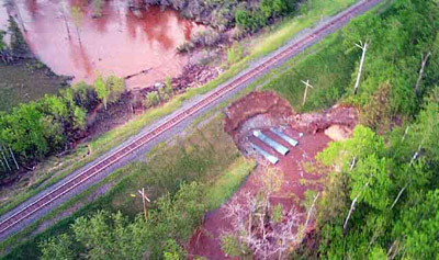
Rainy River Washout, June 11, 2002
Description
- Media Type
- Image
- Item Type
- Photographs
- Description
- An aerial view of the washout from the extensive rains that caused the flooding of the Rainy River area in June of 2002. This view is approximately 135 miles west of Rainy River.
- Date of Original
- June 11 2002
- Subject(s)
- Geographic Coverage
-
-
Ontario, Canada
Latitude: 48.71664 Longitude: -94.56711
-
- Copyright Statement
- Copyright status unknown. Responsibility for determining the copyright status and any use rests exclusively with the user.
- Contact
- Thunder Bay Public LibraryEmail:research@tbpl.ca
Website:
Agency street/mail address:Brodie Resource Library
216 South Brodie Street
Thunder Bay, ON
P7E 1C2


