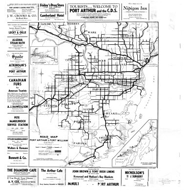
Road Map of Port Arthur & Fort William District
Description
- Creator
- Garwood, C.S., Compiler
- Media Type
- Image
- Item Type
- Maps
- Description
- Thunder Bay District Maps ; Port Arthur District Maps ; Fort William District Maps ; Road Maps ; Main Roads ; Tourism Maps
- Notes
- Map housed at the Brodie Resource Library
- Inscriptions
- Compiled by C.S. Garwood from Dept. of Northern Development Data
- Subject(s)
- Local identifier
- TB-T 2649
- Collection
- Maps
- Language of Item
- English
- Geographic Coverage
-
-
Ontario, Canada
Latitude: 48.6168 Longitude: -89.65014 -
Ontario, Canada
Latitude: 48.5668 Longitude: -89.28342 -
Ontario, Canada
Latitude: 48.2668 Longitude: -89.81687 -
Ontario, Canada
Latitude: 48.0834 Longitude: -89.63345
-
- Copyright Statement
- Copyright status unknown. Responsibility for determining the copyright status and any use rests exclusively with the user.
- Contact
- Thunder Bay Public LibraryEmail:research@tbpl.ca
Website:
Agency street/mail address:Brodie Resource Library
216 South Brodie Street
Thunder Bay, ON
P7E 1C2