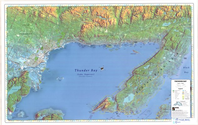
Thunder Bay (Lake Superior Gitchee Gumee)
Description
- Media Type
- Image
- Item Type
- Maps
- Description
- Satellite Imagery ; Recreation Maps ; Thunder Bay Area ; Sibley Provincial Park ; Digital Elevation Maps
- Notes
- Map housed at the Brodie Resource Library
- Publisher
- MERMAP Cartographics under license from Ontario Ministry of Natural Resources
- Date of Publication
- 2007
- Map Scale
- 1:78,000
- Subject(s)
- Corporate Name(s)
- Ontario Ministry of Natural Resources
- Local identifier
- Map 209
- Collection
- Maps
- Language of Item
- English
- Geographic Coverage
-
-
Ontario, Canada
Latitude: 48.4168 Longitude: -88.75008 -
Ontario, Canada
Latitude: 48.3334 Longitude: -88.81678 -
Ontario, Canada
Latitude: 48.401388 Longitude: -89.267777
-
- Copyright Statement
- Protected by copyright: Uses other than research or private study require the permission of the rightsholder(s). Responsibility for obtaining permissions and for any use rests exclusively with the user.
- Copyright Date
- 2007
- Copyright Holder
- MERMAP
- Copyright Holder Contact Information
- www.mermap.ca
- Reproduction Notes
- No part of this publication may be reproduced or transmitted in any form or by any means, electronic or mechanical, including photocopying, recording, or by any information storage and retrieval systems without written permission from the publisher, MERMAP Cartographics.
- Contact
- Thunder Bay Public LibraryEmail:research@tbpl.ca
Website:
Agency street/mail address:Brodie Resource Library
216 South Brodie Street
Thunder Bay, ON
P7E 1C2