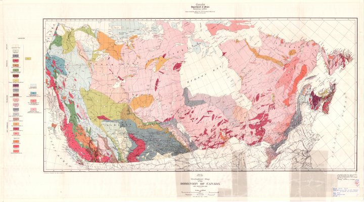
Geological Map of the Dominion of Canada and Newfoundland
Description
- Creator
- Senecal, C.O., Draftsman
- Media Type
- Image
- Item Type
- Maps
- Description
- Geological Maps ; Geological Surveys ; Land Formations ; Canada Maps
- Notes
- Map housed at the Brodie Resource Library
- Publisher
- Canada Department of Mines
- Date of Publication
- 1913
- Map Scale
- 1:6,336,000
- Subject(s)
- Corporate Name(s)
- Canada Department of Mines
- Local identifier
- GSC 91A
- Collection
- Maps
- Language of Item
- English
- Copyright Statement
- Copyright status unknown. Responsibility for determining the copyright status and any use rests exclusively with the user.
- Contact
- Thunder Bay Public LibraryEmail:research@tbpl.ca
Website:
Agency street/mail address:Brodie Resource Library
216 South Brodie Street
Thunder Bay, ON
P7E 1C2