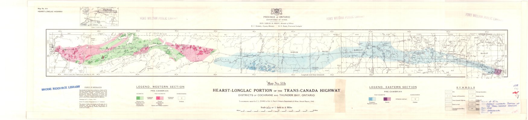
Hearst-Longlac Portion of the Trans-Canada Highway : Districts of Cochrane and Thunder Bay, Ontario
Description
- Media Type
- Image
- Item Type
- Maps
- Description
- Geological Maps ; Hearst ; Longlac ; Trans-Canada Highway ; Land Formations ; Cochrane District Maps ; Thunder Bay District Maps
- Notes
- Map housed at the Brodie Resource Library
- Inscriptions
- To accompany report by E.L. Evans in Vol. LI, Part 9, Ontario Department of Mines Annual Report, 1942
- Publisher
- Province of Ontario Department of Mines
- Date of Publication
- 1942
- Map Scale
- 1:253,440
- Subject(s)
- Corporate Name(s)
- Province of Ontario Department of Mines
- Local identifier
- G 51h
- Collection
- Maps
- Language of Item
- English
- Geographic Coverage
-
-
Ontario, Canada
Latitude: 49.68351 Longitude: -83.66654 -
Ontario, Canada
Latitude: 49.80014 Longitude: -86.51666
-
- Copyright Statement
- Copyright status unknown. Responsibility for determining the copyright status and any use rests exclusively with the user.
- Contact
- Thunder Bay Public LibraryEmail:research@tbpl.ca
Website:
Agency street/mail address:Brodie Resource Library
216 South Brodie Street
Thunder Bay, ON
P7E 1C2