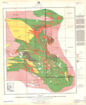
Mississagi Reserve and Goulais River Iron Ranges : Districts of Algoma and Sudbury, Ontario
Description
- Media Type
- Image
- Item Type
- Maps
- Description
- Mississagi Reserve ; Goulais River ; Iron Ranges ; Geological Maps ; Algoma District ; Sudbury District ; Land Formations
- Notes
- Map housed at the Brodie Resource Library
- Inscriptions
- Township and mining claim plans from Surveys Branch, Dept. of Lands and Forests, Ontario. Geology by E.S. Moore, 1924. Drawn for photo-lithography by A. Braidwood.
To accompany report by E.S. Moore in Vol. XXXIV, part 4, Ontario Department of Mines Report, 1925. - Publisher
- Province of Ontario Department of Mines
- Date of Publication
- 1925
- Map Scale
- 1:63,360
- Subject(s)
- Corporate Name(s)
- Province of Ontario Department of Mines
- Local identifier
- G 34d
- Collection
- Maps
- Language of Item
- English
- Geographic Coverage
-
-
Ontario, Canada
Latitude: 46.71677 Longitude: -84.38324 -
Ontario, Canada
Latitude: 46.21676 Longitude: -82.99987
-
- Copyright Statement
- Copyright status unknown. Responsibility for determining the copyright status and any use rests exclusively with the user.
- Contact
- Thunder Bay Public LibraryEmail:research@tbpl.ca
Website:
Agency street/mail address:Brodie Resource Library
216 South Brodie Street
Thunder Bay, ON
P7E 1C2