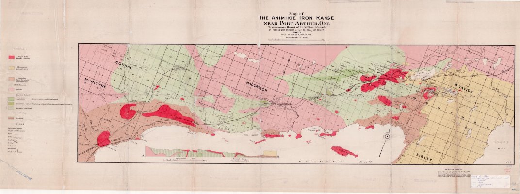
Map of The Animikie Iron Range Near Port Arthur, Ont.
Description
- Creator
- Gibson, Thos. W., Director
- Media Type
- Image
- Item Type
- Maps
- Description
- Animikie Iron Range ; Port Arthur Maps ; Geological Maps
- Notes
- Map housed at the Brodie Resource Library
- Inscriptions
- Geologically surveyed by L.P. Silver and W.A. Begg, 1905. Geological map by W.N. Smith. Sketch map of the Thunder Bay mining region of Lake Superior by E.D. Ingall of the Geological Survey of Canada . Plans of Surveys by the Crown Department of Ontario.
- Date of Publication
- 1906
- Subject(s)
- Corporate Name(s)
- Bureau of Mines
- Local identifier
- G 15a
- Collection
- Maps
- Language of Item
- English
- Geographic Coverage
-
-
Ontario, Canada
Latitude: 48.4001 Longitude: -89.31683
-
- Copyright Statement
- Copyright status unknown. Responsibility for determining the copyright status and any use rests exclusively with the user.
- Contact
- Thunder Bay Public LibraryEmail:research@tbpl.ca
Website:
Agency street/mail address:Brodie Resource Library
216 South Brodie Street
Thunder Bay, ON
P7E 1C2


