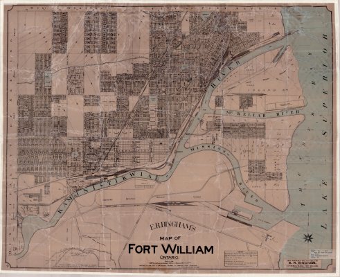
Map of Fort William, Ontario (1913)
Description
- Creator
- E. R. Bingham
- Media Type
- Image
- Item Type
- Maps
- Description
- City map of Fort William, Ontario in 1913. This map by prepared and sold by E.R. Bingham.
To view this map, simply click on the Document (PDF) link located directly underneath the image. - Place of Publication
- Fort William, Ontario
- Date of Original
- 1913
- Subject(s)
- Local identifier
- TB-T 2645
- Collection
- Thunder Bay Public Library
- Geographic Coverage
-
-
Ontario, Canada
Latitude: 48.4001 Longitude: -89.31683
-
- Copyright Statement
- Copyright status unknown. Responsibility for determining the copyright status and any use rests exclusively with the user.
- Contact
- Thunder Bay Public LibraryEmail:research@tbpl.ca
Website:
Agency street/mail address:Brodie Resource Library
216 South Brodie Street
Thunder Bay, ON
P7E 1C2


