Results
- Index of names for the Welland Canal Company's Survey of Land book, 1826. Includes persons name, land cultivated, uncultivated, total land and remarks. The remarks noted include; who surveyed the lanIndex of names for the Welland Canal Company's Survey of Land book, …
- This is an index of all the names contained within the Survey of Lands. The names are listed in alphabetical order and are paired with page numbers where more information can be found on the individuThis is an index of all the names contained within the Survey …
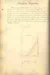
- Survey map and description of Jacob Neff Sr.'s land created by The Welland Canal Company. Included is a written description of the land along with a drawing of the land. Noteable features include; caSurvey map and description of Jacob Neff Sr.'s land created by The …
- Survey map and description of William May Jr.'s land created by The Welland Canal Company. Included is a written description of the land along with a drawing of the land. The land is described as havSurvey map and description of William May Jr.'s land created by The …
- Survey map and description of Peter May's land created by The Welland Canal Company. Included is a written description of the land along with a drawing of the land. Noteable features include; a largeSurvey map and description of Peter May's land created by The Welland …
- Updated survey description of William May's land created by The Welland Canal Company. The land is now in the posession of Christian May as he was the heir for the property. The drawing for the propeUpdated survey description of William May's land created by The Welland Canal …
- Survey map and description of Robert Brown's land created by The Welland Canal Company. Included is a two page written description of the land along with a drawing of the land. Noteable features inclSurvey map and description of Robert Brown's land created by The Welland …
- Survey map and description of Robert Brown's land created by The Welland Canal Company. Included is a two page written description of the land along with a drawing of the land. Noteable features inclSurvey map and description of Robert Brown's land created by The Welland …
- Survey map and description of John Martindale's land created by The Welland Canal Company. Included is a written description of the land along with a drawing of the land. Noteable features include; pSurvey map and description of John Martindale's land created by The Welland …
- Survey map and description of Samuel Wood's land created by The Welland Canal Company. Included is a written description of the land along with a drawing of the land. The same description of the landSurvey map and description of Samuel Wood's land created by The Welland …
- See also record for page 36. The land was required for canal towpath and lock house.See also record for page 36. The land was required for canal …
- Survey map and description of Jesse Willson's land created by The Welland Canal Company. Included is a written description of the land along with a drawing of the land. Noteable features include; WelSurvey map and description of Jesse Willson's land created by The Welland …
- Survey map and description of Jacob Augustine's land created by The Welland Canal Company. Included is a written description of the land along with a drawing of the land. The land surveyed is lot #26Survey map and description of Jacob Augustine's land created by The Welland …
- Survey map and description of Jacob Augustine's land created by The Welland Canal Company. Included is a written description of the land along with a drawing of the land. The land surveyed is lot #27Survey map and description of Jacob Augustine's land created by The Welland …
- Survey map and description of Abraham Neff's land created by The Welland Canal Company. Included is a written description of the land along with a drawing of the land. Noteable features include; lineSurvey map and description of Abraham Neff's land created by The Welland …
- Survey map and description of Jacob Neff Js.'s land created by The Welland Canal Company. Included is a written description of the land along with a drawing of the land. Noteable features include; caSurvey map and description of Jacob Neff Js.'s land created by The …
- See also Pp. 148-151See also Pp. 148-151
- Survey map of the land for the Mill Scibes Grand River Dam. Created by The Welland Canal Company. Included is a drawing of the land. Noteable features include; Sulphur Creek, post, bridge, Grand RiveSurvey map of the land for the Mill Scibes Grand River Dam. …
- Survey map and description of the land at the cut of the Chippewa or Welland River. Created by The Welland Canal Company. Included is a drawing of the land along with brief surveyors notes. NoteableSurvey map and description of the land at the cut of the …
Brock Images are created and maintained by the Special Collections and Archives, James A. Gibson Library, Brock University.


