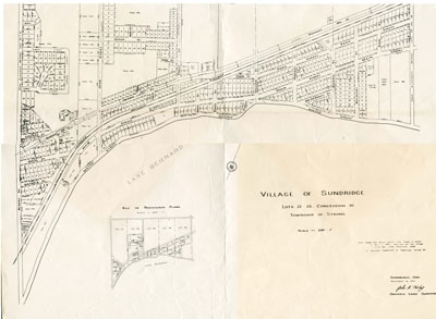
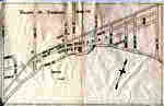
Village of Sundridge Map, Lots 21 - 25 Con. 10, Township of Strong
Description
- Creator
- John R. Hiley, Surveyor
- Media Type
- Image
- Item Type
- Maps
- Description
- Map of the village of Sundridge 1957. It includes all the main streets and secondary streets of Sundridge. The map shows the deed numbers of all the properties in the village.
- Date of Original
- November 16, 1957
- Dimensions
-
Width: 12 in
Height: 12 in
- Image Dimensions
-
Image Width: 12in
Image Height: 12in
- Subject(s)
- Local identifier
- Maps File
- Language of Item
- English
- Geographic Coverage
-
-
Ontario, Canada
Latitude: 45.7668 Longitude: -79.39964
-
- Creative Commons licence
 [more details]
- Copyright Statement
- Protected by copyright: Uses other than research or private study require the permission of the rightsholder(s). Responsibility for obtaining permissions and for any use rests exclusively with the user.
- Copyright Date
- 1957
- Copyright Holder
- E.J.Williams Surveying Ltd.
- Recommended Citation
- Unknown
- Terms of Use
- For Educational Purposes
- Reproduction Notes
- For Educational Purposes
- Contact
- Sundridge - Strong Union PLEmail:sundridgelibrary@gmail.com
Website:
Agency street/mail address:Box 429, 110 Main St.
Sundridge, ON P0A 1Z0