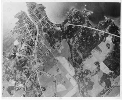
Aerial View of Thessalon, Summer, circa 1940
Description
- Mystery Question
- Do you know what year this photo was taken?[Please answer by clicking on the Comments tab]
- Media Type
- Image
- Item Type
- Photographs
- Description
- This is a reproduction of a black and white aerial photo of Thessalon and surrounding area . The point of land at the top of the photo is bisected by the Thessalon River which continues in a north south direction through the Town.
The town layout is visible as well as the unpopulated areas to the north and west.
- Notes
- This unmarked and undated photo was located in miscellaneous municipal files and permission was granted to scan this photo to add to our local collection.
- Date of Original
- Circa 1940
- Dimensions
-
Width: 10 px
Height: 8 px
- Subject(s)
- Local identifier
- Thessalon Municipal Office
- Language of Item
- English
- Geographic Coverage
-
-
Ontario, Canada
Latitude: 46.25006 Longitude: -83.5666
-
- Copyright Statement
- Protected by copyright: Uses other than research or private study require the permission of the rightsholder(s). Responsibility for obtaining permissions and for any use rests exclusively with the user.
- Contact
- Heritage Park MuseumEmail:thessalonlib@hotmail.com
Agency street/mail address:P.O. Box 425
Thessalon, ON
P0R 1L0

