Results
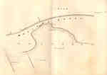
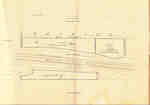
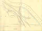
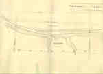
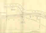
- Survey map of the Second Welland Canal created by the Welland Canal Company showing a portion of the Grantham Township near Port Dalhousie. Identified structures associated with the Canal include theSurvey map of the Second Welland Canal created by the Welland Canal …
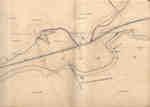
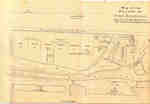
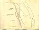
- Survey map of the Second Welland Canal created by the Welland Canal Company showing a portion of the Grantham Township. Identified structures associated with the Canal include the floating tow path aSurvey map of the Second Welland Canal created by the Welland Canal …
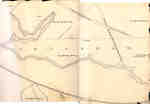
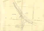
- Survey map of the Second Welland Canal created by the Welland Canal Company showing a portion of the Grantham Township near Port Dalhousie. Identified structures associated with the Canal include theSurvey map of the Second Welland Canal created by the Welland Canal …
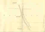
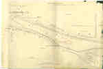
- Survey map of the Second Welland Canal created by the Welland Canal Company showing the area between the Townships of Louth and Grantham. Identified structures associated with the Canal include the fSurvey map of the Second Welland Canal created by the Welland Canal …
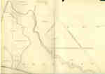
- Survey map of the Second Welland Canal created by the Welland Canal Company showing a portion of the Grantham Township. Identified structures associated with the Canal include the floating tow path.Survey map of the Second Welland Canal created by the Welland Canal …
- Survey map of the Second Welland Canal created by the Welland Canal Company showing the canal in the Thorold Township just south of Allanburgh. Identified structures and features associated with theSurvey map of the Second Welland Canal created by the Welland Canal …
- Survey map of the Second Welland Canal created by the Welland Canal Company showing the canal in the Thorold Township between Allanburg and Port Robinson. Identified structures and features associateSurvey map of the Second Welland Canal created by the Welland Canal …
- Survey map of the Second Welland Canal created by the Welland Canal Company showing the canal at Port Robinson. Identified structures and features associated with the Canal include the Deep Cut, OldSurvey map of the Second Welland Canal created by the Welland Canal …
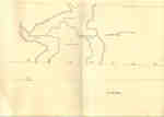
- Survey map of the Second Welland Canal created by the Welland Canal Company showing the canal in Thorold Township near Port Robinson. Identified structures associated with the Canal include towing paSurvey map of the Second Welland Canal created by the Welland Canal …
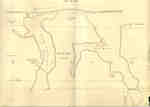
- Survey map of the Second Welland Canal created by the Welland Canal Company showing the Back Water from the canal in Thorold Township near Port Robinson. The surveyors' measurements and notes can beSurvey map of the Second Welland Canal created by the Welland Canal …
- Survey map of the Second Welland Canal created by the Welland Canal Company showing the canal along Chippewa Creek in Thorold Township. Identified structures and features associated with the Canal inSurvey map of the Second Welland Canal created by the Welland Canal …
- Survey map of the Second Welland Canal created by the Welland Canal Company showing the canal along Chippewa Creek in Thorold Township. Identified structures and features associated with the Canal inSurvey map of the Second Welland Canal created by the Welland Canal …
- Survey map of the Second Welland Canal created by the Welland Canal Company showing the canal in the Thorold Township between Port Robinson and Welland. Identified structures and features associatedSurvey map of the Second Welland Canal created by the Welland Canal …
- Survey map of the Second Welland Canal created by the Welland Canal Company showing the canal in the Thorold Township between Port Robinson and Welland. Identified structures and features associatedSurvey map of the Second Welland Canal created by the Welland Canal …
- Survey map of the Second Welland Canal created by the Welland Canal Company showing the canal in the Thorold Township between Port Robinson and Welland. Identified structures and features associatedSurvey map of the Second Welland Canal created by the Welland Canal …
- Survey map of the Second Welland Canal created by the Welland Canal Company showing the canal in the Thorold Township between Port Robinson and Welland. Identified structures and features associatedSurvey map of the Second Welland Canal created by the Welland Canal …
- Survey map of the Second Welland Canal created by the Welland Canal Company showing the township of Crowland as well as the Village of Welland-Merritville. Identified structures associated with the CSurvey map of the Second Welland Canal created by the Welland Canal …
- Survey map of the Second Welland Canal created by the Welland Canal Company showing the border area of the townships of Crowland and Humberstone. Identified structures associated with the Canal incluSurvey map of the Second Welland Canal created by the Welland Canal …
- Survey map of the Second Welland Canal created by the Welland Canal Company showing the area through Humberstone. Identified structures associated with the Canal include Spoil Banks, Towing Path, BacSurvey map of the Second Welland Canal created by the Welland Canal …
Brock Images are created and maintained by the Special Collections and Archives, James A. Gibson Library, Brock University.


