Welland Canal Records
Survey maps and records concerning the construction and course of the First and Second Welland Canal through the Niagara Peninsula. These records span the years 1826 to the 1860s.
Records
Results
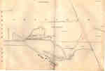
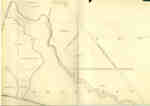
- Survey map of the Second Welland Canal created by the Welland Canal Company showing the areas in and around Port Dalhousie and Grantham Township. Identified structures associated with the Canal incluSurvey map of the Second Welland Canal created by the Welland Canal …
- Survey map of the Second Welland Canal created by the Welland Canal Company showing the areas in and around Port Dalhousie and Grantham Township. Identified structures associated with the Canal incluSurvey map of the Second Welland Canal created by the Welland Canal …
- Survey map of the Second Welland Canal created by the Welland Canal Company showing a portion of the Grantham Township near Port Dalhousie. Identified structures associated with the Canal include theSurvey map of the Second Welland Canal created by the Welland Canal …
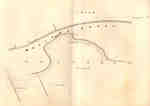
- Survey map of the Second Welland Canal created by the Welland Canal Company showing a portion of the Grantham Township. Identified structures associated with the Canal include the floating tow path aSurvey map of the Second Welland Canal created by the Welland Canal …
- Survey map of the Second Welland Canal created by the Welland Canal Company showing a portion of the Grantham Township near Port Dalhousie. Identified structures associated with the Canal include theSurvey map of the Second Welland Canal created by the Welland Canal …
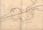
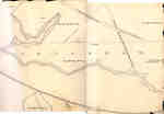
- Survey map of the Second Welland Canal created by the Welland Canal Company showing the area between the Townships of Grantham and Louth. Identified structures associated with the Canal include the fSurvey map of the Second Welland Canal created by the Welland Canal …
- Survey map of the Second Welland Canal created by the Welland Canal Company showing the area between the Townships of Louth and Grantham. Identified structures associated with the Canal include the fSurvey map of the Second Welland Canal created by the Welland Canal …
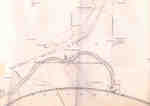
- Survey map of the Second Welland Canal created by the Welland Canal Company showing a portion of the Grantham Township. Identified structures associated with the Canal include the floating tow path.Survey map of the Second Welland Canal created by the Welland Canal …
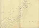
- Survey map of the Second Welland Canal created by the Welland Canal Company along the western edge of the Town of St. Catharines. Although not labelled, the Second Welland Canal can be seen running tSurvey map of the Second Welland Canal created by the Welland Canal …
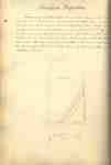
- Survey map and description of Jacob Neff Sr.'s land created by The Welland Canal Company. Included is a written description of the land along with a drawing of the land. Noteable features include; caSurvey map and description of Jacob Neff Sr.'s land created by The …
- Survey map and description of Jacob Augustine's land created by The Welland Canal Company. Included is a written description of the land along with a drawing of the land. The land surveyed is lot #26Survey map and description of Jacob Augustine's land created by The Welland …
- Survey map and description of Jacob Augustine's land created by The Welland Canal Company. Included is a written description of the land along with a drawing of the land. The land surveyed is lot #27Survey map and description of Jacob Augustine's land created by The Welland …
- Survey map and description of Abraham Neff's land created by The Welland Canal Company. Included is a written description of the land along with a drawing of the land. Noteable features include; lineSurvey map and description of Abraham Neff's land created by The Welland …
- Survey map and description of Jacob Neff Js.'s land created by The Welland Canal Company. Included is a written description of the land along with a drawing of the land. Noteable features include; caSurvey map and description of Jacob Neff Js.'s land created by The …
- See also Pp. 148-151See also Pp. 148-151
- Survey map of the land for the Mill Scibes Grand River Dam. Created by The Welland Canal Company. Included is a drawing of the land. Noteable features include; Sulphur Creek, post, bridge, Grand RiveSurvey map of the land for the Mill Scibes Grand River Dam. …
- Survey map and description of the land at the cut of the Chippewa or Welland River. Created by The Welland Canal Company. Included is a drawing of the land along with brief surveyors notes. NoteableSurvey map and description of the land at the cut of the …
- See also page 161. Please note the measurments listed under "overall dimensions" are for the text only if the text appears on a seperate page from the drawing.See also page 161. Please note the measurments listed under "overall dimensions" …
- Survey map of the lands of the Welland Canal Company in Thorold. Created by The Welland Canal Company. Noteable features include; Company's land, reservoir, channel of canal, bridge, Pine street, MulSurvey map of the lands of the Welland Canal Company in Thorold. …
Brock Images are created and maintained by the Special Collections and Archives, James A. Gibson Library, Brock University.


