
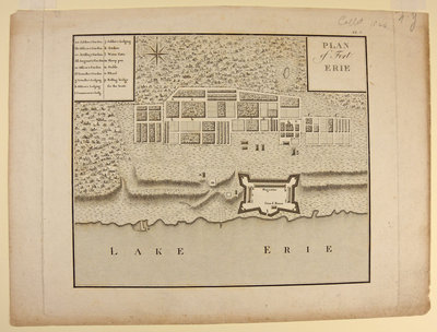
Plan of Fort Erie.
Description
- Sponsors

 This item is a part of the 1812 History digitization project. This project was made possible with the support of the Department of Canadian Heritage through the Canadian Culture Online Strategy.
- Creator
- Unknown
- Media Type
- Image
- Item Type
- Prints
- Description
- An ink print believed to have been created in England during the 18th Century.
- Subject(s)
- Local identifier
- 982.608
- Geographic Coverage
-
-
Ontario, Canada
Latitude: 42.90012 Longitude: -78.93286
-
- Copyright Statement
- Protected by copyright: Uses other than research or private study require the permission of the rightsholder(s). Responsibility for obtaining permissions and for any use rests exclusively with the user.
- Terms of Use
- Please contact the RiverBrink Art Museum for any reproductions of this image.
- Contact
- RiverBrink Art MuseumEmail:curator@riverbrink.org
Website:
Address:116 Queenston St.
PO Box 266
Queenston, ON
L0S 1L0
Create electronic postcard
Plan of Fort Erie.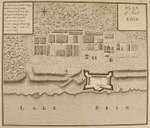
Groups of Related Records
Other Web sites/External links
